Area Overview for E3 5BN
Photos of E3 5BN


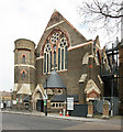

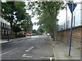
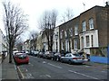
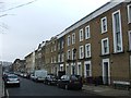

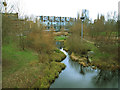
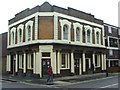
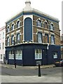
100 photos from this area
Area Information
Key information about the E3 5BN including its size, population, and administrative classification.
- Area Type
- Postcode
- Area Size
- 6090 m²
- Population
- 1947
- Population Density
- 15343 people/km²
House Prices in E3 5BN
52
Properties
£445,278
Average Sold Price
£38,500
Lowest Price
£1,030,000
Highest Price
Showing 52 properties
| Address | Type | Beds | Baths | Last Sale Price | Last Sale Date | |
|---|---|---|---|---|---|---|
| 128 Antill Road, London, E3 5BN | Flat | 2 | 1 | £500,000 | May 2023 | |
| 126 Antill Road, London, E3 5BN | Detached | 3 | 1 | £1,030,000 | Aug 2022 | |
| 122 Antill Road, London, E3 5BN | house | 3 | - | £875,000 | Sep 2019 | |
| 124 Antill Road, London, E3 5BN | Terraced | 3 | 1 | £840,000 | Aug 2019 | |
| 142 Antill Road, London, E3 5BN | Terraced | 2 | 1 | £665,000 | Apr 2014 | |
| 104 Antill Road, London, E3 5BN | house | 3 | - | £625,000 | Sep 2013 | |
| 120 Antill Road, London, E3 5BN | Terraced | 4 | 1 | £525,000 | Sep 2012 | |
| 132 Antill Road, London, E3 5BN | house | 3 | - | £535,000 | Feb 2012 | |
| 158 Antill Road, London, E3 5BN | house | - | - | £525,000 | Dec 2011 | |
| 138 Antill Road, London, E3 5BN | house | 3 | - | £524,000 | Sep 2010 |
Page 1 of 6
Energy Efficiency in E3 5BN
Amenities
Schools
| Rank | School | Type | Entry gender | Ages |
|---|
Explore more schools in this area
Go to Schools tabDemographics
Household Size
Family (3-5 people)
most common
Accommodation Type
Houses
most common
Tenure
39
majority
Ethnic Group
White
most common
Religion
N/A
most common
Household Composition
N/A
most common
Age
47
median
Adults (30-64 years)
most common
Household Deprivation
N/A
with no deprivation
NS-SEC
49
in Lower managerial occupations
Explore more demographic insights in this area
Go to Demographics tabPlanning
Planning Constraints
- Flood RiskPremium
- Ramsar Wetland SitesPremium
- Area of Outstanding Natural BeautyPremium
- Protected Nature ReservePremium
- Protected WoodlandPremium