Area Overview for E18 2EH
Photos of E18 2EH
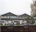
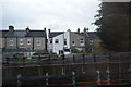
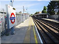
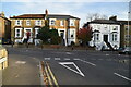

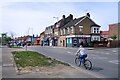
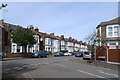
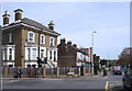
37 photos from this area
Area Information
Key information about the E18 2EH including its size, population, and administrative classification.
- Area Type
- Postcode
- Area Size
- 5965 m²
- Population
- 1934
- Population Density
- 7546 people/km²
House Prices in E18 2EH
22
Properties
£392,300
Average Sold Price
£86,500
Lowest Price
£538,500
Highest Price
Showing 22 properties
| Address | Type | Beds | Baths | Last Sale Price | Last Sale Date | |
|---|---|---|---|---|---|---|
| 35 Beechwood Park, South Woodford, London, E18 2EH | Flat | 3 | 2 | £538,500 | Jul 2025 | |
| 37 Beechwood Park, South Woodford, London, E18 2EH | Maisonette | - | - | £512,500 | Jul 2024 | |
| 23 Beechwood Park, South Woodford, London, E18 2EH | Flat | - | - | £470,000 | May 2023 | |
| 43 Beechwood Park, South Woodford, London, E18 2EH | Flat | - | - | £475,000 | Apr 2023 | |
| 3 Beechwood Park, South Woodford, London, E18 2EH | Flat | 3 | 1 | £485,000 | Sep 2022 | |
| 15 Beechwood Park, South Woodford, London, E18 2EH | Maisonette | - | - | £530,000 | Jul 2022 | |
| 41 Beechwood Park, South Woodford, London, E18 2EH | Flat | 3 | 1 | £503,000 | Mar 2022 | |
| 21 Beechwood Park, South Woodford, London, E18 2EH | Flat | 3 | 1 | £490,000 | Feb 2022 | |
| 25 Beechwood Park, South Woodford, London, E18 2EH | Flat | - | - | £500,000 | Nov 2018 | |
| 33 Beechwood Park, South Woodford, London, E18 2EH | Maisonette | 3 | - | £340,000 | May 2014 |
Page 1 of 3
Energy Efficiency in E18 2EH
Amenities
Schools
| Rank | School | Type | Entry gender | Ages |
|---|
Explore more schools in this area
Go to Schools tabDemographics
Household Size
Family (3-5 people)
most common
Accommodation Type
Houses
most common
Tenure
60
majority
Ethnic Group
White
most common
Religion
N/A
most common
Household Composition
N/A
most common
Age
47
median
Adults (30-64 years)
most common
Household Deprivation
N/A
with no deprivation
NS-SEC
56
in Lower managerial occupations
Explore more demographic insights in this area
Go to Demographics tabPlanning
Planning Constraints
- Flood RiskPremium
- Ramsar Wetland SitesPremium
- Area of Outstanding Natural BeautyPremium
- Protected Nature ReservePremium
- Protected WoodlandPremium