Area Overview for E18 1PR
Photos of E18 1PR


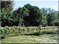
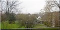
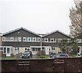
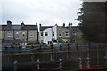

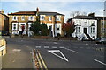

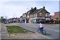
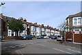
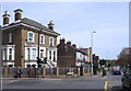
37 photos from this area
Area Information
Key information about the E18 1PR including its size, population, and administrative classification.
- Area Type
- Postcode
- Area Size
- 8259 m²
- Population
- 2105
- Population Density
- 3960 people/km²
House Prices in E18 1PR
40
Properties
£589,397
Average Sold Price
£40,000
Lowest Price
£975,000
Highest Price
Showing 40 properties
| Address | Type | Beds | Baths | Last Sale Price | Last Sale Date | |
|---|---|---|---|---|---|---|
| 65 Pulteney Road, South Woodford, London, E18 1PR | Detached | 3 | 1 | £768,440 | Sep 2025 | |
| 23 Pulteney Road, South Woodford, London, E18 1PR | Terraced | 4 | 2 | £850,000 | Jul 2024 | |
| 61 Pulteney Road, South Woodford, London, E18 1PR | house | 4 | - | £765,000 | Apr 2023 | |
| 15 Pulteney Road, South Woodford, London, E18 1PR | Terraced | 3 | 1 | £942,000 | Nov 2022 | |
| 75B Pulteney Road, South Woodford, London, E18 1PR | Flat | 1 | 1 | £321,000 | Nov 2022 | |
| 69 Pulteney Road, South Woodford, London, E18 1PR | Terraced | 5 | 3 | £975,000 | Oct 2022 | |
| 17 Pulteney Road, South Woodford, London, E18 1PR | Retail | 4 | 1 | £916,547 | Aug 2022 | |
| 53 Pulteney Road, South Woodford, London, E18 1PR | Terraced | 4 | 1 | £820,750 | Aug 2022 | |
| 73 Pulteney Road, South Woodford, London, E18 1PR | house | - | - | £850,000 | Mar 2022 | |
| 49 Pulteney Road, South Woodford, London, E18 1PR | house | - | - | £895,000 | Jan 2022 |
Page 1 of 4
Energy Efficiency in E18 1PR
Amenities
Schools
| Rank | School | Type | Entry gender | Ages |
|---|
Explore more schools in this area
Go to Schools tabDemographics
Household Size
Family (3-5 people)
most common
Accommodation Type
Flats
most common
Tenure
54
majority
Ethnic Group
White
most common
Religion
N/A
most common
Household Composition
N/A
most common
Age
47
median
Adults (30-64 years)
most common
Household Deprivation
N/A
with no deprivation
NS-SEC
47
in Lower managerial occupations
Explore more demographic insights in this area
Go to Demographics tabPlanning
Planning Constraints
- Flood RiskPremium
- Ramsar Wetland SitesPremium
- Area of Outstanding Natural BeautyPremium
- Protected Nature ReservePremium
- Protected WoodlandPremium