Area Overview for E17 6LS
Photos of E17 6LS
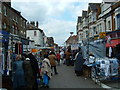

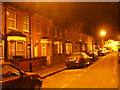
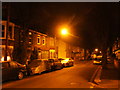
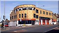
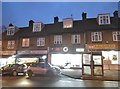
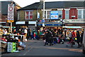
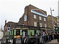
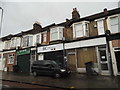

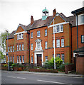
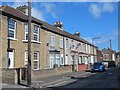
100 photos from this area
Area Information
Key information about the E17 6LS including its size, population, and administrative classification.
- Area Type
- Postcode
- Area Size
- 7304 m²
- Population
- Not available
- Population Density
- Not available
House Prices in E17 6LS
53
Properties
£364,964
Average Sold Price
£25,000
Lowest Price
£921,000
Highest Price
Showing 53 properties
| Address | Type | Beds | Baths | Last Sale Price | Last Sale Date | |
|---|---|---|---|---|---|---|
| 34 Wellington Road, Walthamstow, E17 6LS | Terraced | 3 | 2 | £720,000 | Aug 2024 | |
| 28 Wellington Road, Walthamstow, E17 6LS | Detached | 4 | 2 | £921,000 | Jun 2024 | |
| 18 Wellington Road, Walthamstow, E17 6LS | Terraced | 2 | 2 | £770,000 | Jan 2024 | |
| 4 Wellington Road, Walthamstow, E17 6LS | house | - | - | £767,500 | Sep 2022 | |
| 25 Wellington Road, Walthamstow, E17 6LS | house | - | - | £652,775 | Jun 2021 | |
| 21 Wellington Road, Walthamstow, E17 6LS | Terraced | 4 | 2 | £751,000 | Oct 2020 | |
| 15 Wellington Road, Walthamstow, E17 6LS | Terraced | 4 | 1 | £550,000 | Sep 2018 | |
| 33 Wellington Road, Walthamstow, E17 6LS | Terraced | 5 | 2 | £615,000 | Oct 2017 | |
| 9 Wellington Road, Walthamstow, E17 6LS | house | - | - | £510,000 | Oct 2016 | |
| 8 Wellington Road, Walthamstow, E17 6LS | house | - | - | £516,250 | Jan 2016 |
Page 1 of 6
Energy Efficiency in E17 6LS
Amenities
Schools
| Rank | School | Type | Entry gender | Ages |
|---|
Explore more schools in this area
Go to Schools tabDemographics
Household Size
Family (3-5 people)
most common
Accommodation Type
Houses
most common
Tenure
57
majority
Ethnic Group
White
most common
Religion
N/A
most common
Household Composition
N/A
most common
Age
47
median
Adults (30-64 years)
most common
Household Deprivation
N/A
with no deprivation
NS-SEC
37
in Lower managerial occupations
Explore more demographic insights in this area
Go to Demographics tabPlanning
Planning Constraints
- Flood RiskPremium
- Ramsar Wetland SitesPremium
- Area of Outstanding Natural BeautyPremium
- Protected Nature ReservePremium
- Protected WoodlandPremium