Area Overview for E17 6JQ
Photos of E17 6JQ
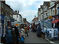
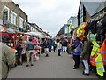
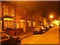
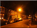
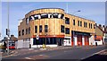
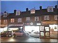
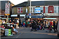
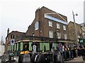
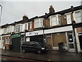

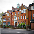
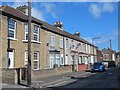
100 photos from this area
Area Information
Key information about the E17 6JQ including its size, population, and administrative classification.
- Area Type
- Postcode
- Area Size
- 7577 m²
- Population
- Not available
- Population Density
- Not available
House Prices in E17 6JQ
54
Properties
£277,604
Average Sold Price
£62,000
Lowest Price
£655,000
Highest Price
Showing 54 properties
| Address | Type | Beds | Baths | Last Sale Price | Last Sale Date | |
|---|---|---|---|---|---|---|
| 100 Forest Road, Walthamstow, E17 6JQ | Terraced | 3 | 2 | £655,000 | Dec 2022 | |
| 172 Forest Road, Walthamstow, E17 6JQ | Terraced | 3 | 2 | £570,000 | Jul 2020 | |
| 162 Forest Road, Walthamstow, E17 6JQ | Terraced | 4 | 1 | £635,000 | Apr 2019 | |
| 166 Forest Road, Walthamstow, E17 6JQ | house | - | - | £271,100 | Jan 2017 | |
| 156A Forest Road, Walthamstow, E17 6JQ | Flat | 4 | 2 | £285,000 | Mar 2016 | |
| 168 Forest Road, Walthamstow, E17 6JQ | house | 3 | - | £345,000 | Oct 2013 | |
| 138A Forest Road, Walthamstow, E17 6JQ | Flat | - | - | £174,250 | Mar 2010 | |
| 126 Forest Road, Walthamstow, E17 6JQ | house | - | - | £141,000 | May 2003 | |
| 142 Forest Road, Walthamstow, E17 6JQ | house | - | - | £142,000 | Feb 2003 | |
| 132A Forest Road, Walthamstow, E17 6JQ | Flat | - | - | £160,000 | Dec 2001 |
Page 1 of 6
Energy Efficiency in E17 6JQ
Amenities
Schools
| Rank | School | Type | Entry gender | Ages |
|---|
Explore more schools in this area
Go to Schools tabDemographics
Household Size
Family (3-5 people)
most common
Accommodation Type
Houses
most common
Tenure
57
majority
Ethnic Group
White
most common
Religion
N/A
most common
Household Composition
N/A
most common
Age
47
median
Adults (30-64 years)
most common
Household Deprivation
N/A
with no deprivation
NS-SEC
37
in Lower managerial occupations
Explore more demographic insights in this area
Go to Demographics tabPlanning
Planning Constraints
- Flood RiskPremium
- Ramsar Wetland SitesPremium
- Area of Outstanding Natural BeautyPremium
- Protected Nature ReservePremium
- Protected WoodlandPremium