Area Overview for E15 2BE
Photos of E15 2BE
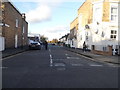
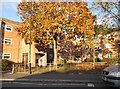
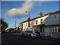
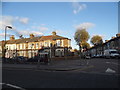
90 photos from this area
Area Information
Key information about the E15 2BE including its size, population, and administrative classification.
- Area Type
- Postcode
- Area Size
- 5398 m²
- Population
- 1742
- Population Density
- 15254 people/km²
House Prices in E15 2BE
28
Properties
£396,714
Average Sold Price
£58,500
Lowest Price
£670,000
Highest Price
Showing 28 properties
| Address | Type | Beds | Baths | Last Sale Price | Last Sale Date | |
|---|---|---|---|---|---|---|
| 13 Amethyst Road, Stratford, E15 2BE | Terraced | 2 | 1 | £670,000 | Apr 2024 | |
| 1 Amethyst Road, Stratford, E15 2BE | Semi-detached | 3 | 1 | £520,000 | Feb 2024 | |
| 28 Amethyst Road, Stratford, E15 2BE | Terraced | 2 | 1 | £515,000 | Dec 2023 | |
| 19 Amethyst Road, Stratford, E15 2BE | Terraced | 2 | 2 | £630,000 | Mar 2023 | |
| 10 Amethyst Road, Stratford, E15 2BE | Terraced | 2 | 1 | £513,000 | Feb 2022 | |
| 25 Amethyst Road, Stratford, E15 2BE | Terraced | - | - | £500,000 | Jan 2022 | |
| 7 Amethyst Road, Stratford, E15 2BE | house | - | - | £565,000 | Aug 2018 | |
| 24 Amethyst Road, Stratford, E15 2BE | Terraced | 2 | 1 | £401,500 | Jan 2016 | |
| 30 Amethyst Road, Stratford, E15 2BE | Terraced | 2 | 1 | £310,000 | Jul 2014 | |
| 21 Amethyst Road, Stratford, E15 2BE | Terraced | 2 | 1 | £230,000 | Sep 2013 |
Page 1 of 3
Energy Efficiency in E15 2BE
Amenities
Schools
| Rank | School | Type | Entry gender | Ages |
|---|
Explore more schools in this area
Go to Schools tabDemographics
Household Size
Family (3-5 people)
most common
Accommodation Type
Houses
most common
Tenure
34
majority
Ethnic Group
White
most common
Religion
N/A
most common
Household Composition
N/A
most common
Age
47
median
Adults (30-64 years)
most common
Household Deprivation
N/A
with no deprivation
NS-SEC
27
in Lower managerial occupations
Explore more demographic insights in this area
Go to Demographics tabPlanning
Planning Constraints
- Flood RiskPremium
- Ramsar Wetland SitesPremium
- Area of Outstanding Natural BeautyPremium
- Protected Nature ReservePremium
- Protected WoodlandPremium