Area Overview for E15 2BT
Photos of E15 2BT
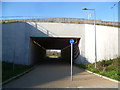
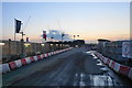
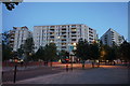
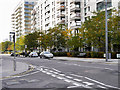
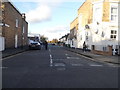
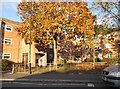
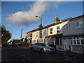
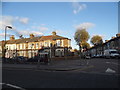
90 photos from this area
Area Information
Key information about the E15 2BT including its size, population, and administrative classification.
- Area Type
- Postcode
- Area Size
- 6029 m²
- Population
- 1742
- Population Density
- 15254 people/km²
House Prices in E15 2BT
40
Properties
£226,909
Average Sold Price
£30,000
Lowest Price
£412,000
Highest Price
Showing 40 properties
| Address | Type | Beds | Baths | Last Sale Price | Last Sale Date | |
|---|---|---|---|---|---|---|
| 45 Hall Road, Stratford, E15 2BT | Terraced | 2 | 1 | £350,000 | Feb 2020 | |
| 41 Hall Road, Stratford, E15 2BT | Terraced | 2 | 1 | £370,000 | Jun 2019 | |
| 36 Hall Road, Stratford, E15 2BT | house | 2 | - | £367,816 | Mar 2019 | |
| 35 Hall Road, Stratford, E15 2BT | Terraced | 2 | 1 | £412,000 | Nov 2018 | |
| 47 Hall Road, Stratford, E15 2BT | house | - | - | £200,000 | Dec 2012 | |
| 33 Hall Road, Stratford, E15 2BT | Terraced | 2 | 1 | £220,000 | Jun 2012 | |
| 51 Hall Road, Stratford, E15 2BT | house | 2 | - | £200,000 | Aug 2011 | |
| 37 Hall Road, Stratford, E15 2BT | house | 2 | 1 | £225,000 | Dec 2010 | |
| 53 Hall Road, Stratford, E15 2BT | Terraced | 2 | 1 | £245,000 | Oct 2007 | |
| 40 Hall Road, Stratford, E15 2BT | Terraced | 2 | 1 | £180,000 | Nov 2006 |
Page 1 of 4
Energy Efficiency in E15 2BT
Amenities
Schools
| Rank | School | Type | Entry gender | Ages |
|---|
Explore more schools in this area
Go to Schools tabDemographics
Household Size
Family (3-5 people)
most common
Accommodation Type
Houses
most common
Tenure
34
majority
Ethnic Group
White
most common
Religion
N/A
most common
Household Composition
N/A
most common
Age
47
median
Adults (30-64 years)
most common
Household Deprivation
N/A
with no deprivation
NS-SEC
27
in Lower managerial occupations
Explore more demographic insights in this area
Go to Demographics tabPlanning
Planning Constraints
- Flood RiskPremium
- Ramsar Wetland SitesPremium
- Area of Outstanding Natural BeautyPremium
- Protected Nature ReservePremium
- Protected WoodlandPremium