Area Overview for E14 3JJ
Photos of E14 3JJ

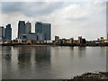
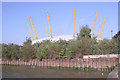

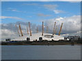
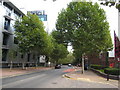
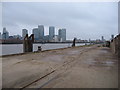


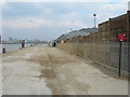
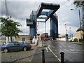
100 photos from this area
Area Information
Key information about the E14 3JJ including its size, population, and administrative classification.
- Area Type
- Postcode
- Area Size
- 5734 m²
- Population
- Not available
- Population Density
- Not available
House Prices in E14 3JJ
35
Properties
£294,280
Average Sold Price
£55,000
Lowest Price
£715,000
Highest Price
Showing 35 properties
| Address | Type | Beds | Baths | Last Sale Price | Last Sale Date | |
|---|---|---|---|---|---|---|
| 15 Leerdam Drive, London, E14 3JJ | Flat | - | - | £335,000 | Jan 2025 | |
| 35 Leerdam Drive, London, E14 3JJ | Flat | - | - | £435,000 | Oct 2023 | |
| 3 Leerdam Drive, London, E14 3JJ | house | - | - | £638,000 | Jul 2023 | |
| 7 Leerdam Drive, London, E14 3JJ | house | - | - | £715,000 | Jan 2022 | |
| 17 Leerdam Drive, London, E14 3JJ | Flat | - | - | £318,000 | Jun 2021 | |
| 9 Leerdam Drive, London, E14 3JJ | Flat | - | - | £325,000 | May 2021 | |
| 16 Leerdam Drive, London, E14 3JJ | Flat | 1 | 1 | £332,000 | Apr 2019 | |
| 24 Leerdam Drive, London, E14 3JJ | house | 3 | 2 | £595,000 | Jun 2015 | |
| 26 Leerdam Drive, London, E14 3JJ | Semi-detached | 2 | - | £555,000 | Mar 2015 | |
| 23 Leerdam Drive, London, E14 3JJ | house | 3 | - | £475,000 | Aug 2012 |
Page 1 of 4
Energy Efficiency in E14 3JJ
Amenities
Schools
| Rank | School | Type | Entry gender | Ages |
|---|
Explore more schools in this area
Go to Schools tabDemographics
Household Size
Family (3-5 people)
most common
Accommodation Type
Flats
most common
Tenure
32
majority
Ethnic Group
White
most common
Religion
N/A
most common
Household Composition
N/A
most common
Age
47
median
Adults (30-64 years)
most common
Household Deprivation
N/A
with no deprivation
NS-SEC
46
in Lower managerial occupations
Explore more demographic insights in this area
Go to Demographics tabPlanning
Planning Constraints
- Flood RiskPremium
- Ramsar Wetland SitesPremium
- Area of Outstanding Natural BeautyPremium
- Protected Nature ReservePremium
- Protected WoodlandPremium