Area Overview for E13 9DS
Photos of E13 9DS
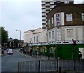
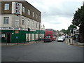
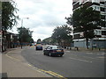
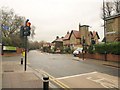
70 photos from this area
Area Information
Key information about the E13 9DS including its size, population, and administrative classification.
- Area Type
- Postcode
- Area Size
- 1.3 hectares
- Population
- 1895
- Population Density
- 15076 people/km²
House Prices in E13 9DS
71
Properties
£203,026
Average Sold Price
£40,000
Lowest Price
£550,000
Highest Price
Showing 71 properties
| Address | Type | Beds | Baths | Last Sale Price | Last Sale Date | |
|---|---|---|---|---|---|---|
| 46 Perth Road, Plaistow, London, E13 9DS | house | - | - | £415,000 | Jul 2023 | |
| 5 Perth Road, Plaistow, London, E13 9DS | Terraced | 3 | 1 | £462,000 | Jul 2022 | |
| 6 Perth Road, Plaistow, London, E13 9DS | Maisonette | - | - | £290,000 | Jun 2021 | |
| 8A Perth Road, Plaistow, London, E13 9DS | Terraced | 4 | 2 | £275,000 | Jun 2020 | |
| 18 Perth Road, Plaistow, London, E13 9DS | Terraced | 3 | - | £375,000 | Sep 2019 | |
| 26 Perth Road, Plaistow, London, E13 9DS | Terraced | 5 | 2 | £350,000 | Oct 2018 | |
| 60 Perth Road, Plaistow, London, E13 9DS | Terraced | 3 | 1 | £405,000 | Jun 2016 | |
| 59 Perth Road, Plaistow, London, E13 9DS | Terraced | 4 | 2 | £550,000 | Apr 2016 | |
| 56 Perth Road, Plaistow, London, E13 9DS | Terraced | 2 | 1 | £335,111 | Aug 2015 | |
| 16 Perth Road, Plaistow, London, E13 9DS | Terraced | 4 | 2 | £295,000 | Jul 2015 |
Page 1 of 8
Energy Efficiency in E13 9DS
Amenities
Schools
| Rank | School | Type | Entry gender | Ages |
|---|
Explore more schools in this area
Go to Schools tabDemographics
Household Size
Family (3-5 people)
most common
Accommodation Type
Houses
most common
Tenure
28
majority
Ethnic Group
asian_total
most common
Religion
N/A
most common
Household Composition
N/A
most common
Age
47
median
Adults (30-64 years)
most common
Household Deprivation
N/A
with no deprivation
NS-SEC
22
in Lower managerial occupations
Explore more demographic insights in this area
Go to Demographics tabPlanning
Planning Constraints
- Flood RiskPremium
- Ramsar Wetland SitesPremium
- Area of Outstanding Natural BeautyPremium
- Protected Nature ReservePremium
- Protected WoodlandPremium