Area Overview for E13 8JU
Photos of E13 8JU
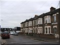
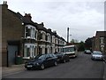
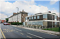
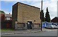
81 photos from this area
Area Information
Key information about the E13 8JU including its size, population, and administrative classification.
- Area Type
- Postcode
- Area Size
- 4063 m²
- Population
- 2261
- Population Density
- 15911 people/km²
House Prices in E13 8JU
25
Properties
£151,286
Average Sold Price
£56,000
Lowest Price
£310,000
Highest Price
Showing 25 properties
| Address | Type | Beds | Baths | Last Sale Price | Last Sale Date | |
|---|---|---|---|---|---|---|
| 148 DENMARK STREET, Plaistow, London, E13 8JU | Detached | 2 | 1 | £310,000 | Feb 2019 | |
| 92 Denmark Street, Plaistow, London, E13 8JU | Terraced | 3 | - | £180,000 | Mar 2008 | |
| 100 Denmark Street, Plaistow, London, E13 8JU | house | 3 | - | £180,000 | Feb 2008 | |
| 156 Denmark Street, Plaistow, London, E13 8JU | Terraced | - | - | £210,000 | Dec 2006 | |
| 142 Denmark Street, Plaistow, London, E13 8JU | Flat | 5 | 1 | £57,500 | Jun 2000 | |
| 146 Denmark Street, Plaistow, London, E13 8JU | Terraced | - | - | £65,500 | Aug 1999 | |
| 154 Denmark Street, Plaistow, London, E13 8JU | Terraced | - | - | £56,000 | Jul 1995 | |
| 152 Denmark Street, Plaistow, London, E13 8JU | Terraced | 3 | 1 | - | - | |
| 150 Denmark Street, Plaistow, London, E13 8JU | Terraced | 3 | 1 | - | - | |
| 142B Denmark Street, Plaistow, London, E13 8JU | Flat | - | - | - | - |
Page 1 of 3
Energy Efficiency in E13 8JU
Amenities
Schools
| Rank | School | Type | Entry gender | Ages |
|---|
Explore more schools in this area
Go to Schools tabDemographics
Household Size
Family (3-5 people)
most common
Accommodation Type
Houses
most common
Tenure
32
majority
Ethnic Group
White
most common
Religion
N/A
most common
Household Composition
N/A
most common
Age
47
median
Adults (30-64 years)
most common
Household Deprivation
N/A
with no deprivation
NS-SEC
20
in Lower managerial occupations
Explore more demographic insights in this area
Go to Demographics tabPlanning
Planning Constraints
- Flood RiskPremium
- Ramsar Wetland SitesPremium
- Area of Outstanding Natural BeautyPremium
- Protected Nature ReservePremium
- Protected WoodlandPremium