Area Overview for E13 0HB
Photos of E13 0HB
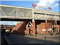
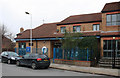
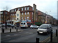
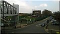
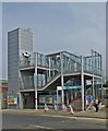
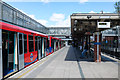
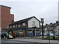
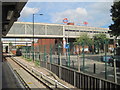
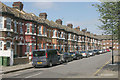
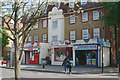
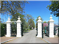
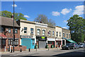
99 photos from this area
Area Information
Key information about the E13 0HB including its size, population, and administrative classification.
- Area Type
- Postcode
- Area Size
- 5.4 hectares
- Population
- 1868
- Population Density
- 8010 people/km²
House Prices in E13 0HB
59
Properties
£224,375
Average Sold Price
£50,000
Lowest Price
£416,000
Highest Price
Showing 59 properties
| Address | Type | Beds | Baths | Last Sale Price | Last Sale Date | |
|---|---|---|---|---|---|---|
| 156 Grange Road, Plaistow, London, E13 0HB | Terraced | 2 | 1 | £416,000 | Jan 2024 | |
| 184 Grange Road, Plaistow, London, E13 0HB | house | - | - | £415,000 | Jun 2022 | |
| 228A Grange Road, Plaistow, London, E13 0HB | Flat | 2 | 1 | £315,000 | Oct 2021 | |
| 174 Grange Road, Plaistow, London, E13 0HB | house | - | - | £415,000 | Jan 2021 | |
| 196 Grange Road, Plaistow, London, E13 0HB | Terraced | 5 | 2 | £350,000 | Jun 2020 | |
| 180 Grange Road, Plaistow, London, E13 0HB | house | - | - | £270,000 | Aug 2019 | |
| 204 Grange Road, Plaistow, London, E13 0HB | house | 1 | 1 | £400,000 | Mar 2016 | |
| 216 Grange Road, Plaistow, London, E13 0HB | Terraced | 5 | 2 | £275,000 | Nov 2014 | |
| 210 Grange Road, Plaistow, London, E13 0HB | Terraced | 3 | 1 | £225,000 | Apr 2013 | |
| 206 Grange Road, Plaistow, London, E13 0HB | house | - | - | £183,000 | Jan 2012 |
Page 1 of 6
Energy Efficiency in E13 0HB
Amenities
Schools
| Rank | School | Type | Entry gender | Ages |
|---|
Explore more schools in this area
Go to Schools tabDemographics
Household Size
Family (3-5 people)
most common
Accommodation Type
Flats
most common
Tenure
25
majority
Ethnic Group
White
most common
Religion
N/A
most common
Household Composition
N/A
most common
Age
47
median
Adults (30-64 years)
most common
Household Deprivation
N/A
with no deprivation
NS-SEC
22
in Lower managerial occupations
Explore more demographic insights in this area
Go to Demographics tabPlanning
Planning Constraints
- Flood RiskPremium
- Ramsar Wetland SitesPremium
- Area of Outstanding Natural BeautyPremium
- Protected Nature ReservePremium
- Protected WoodlandPremium