Area Overview for E13 0DR
Photos of E13 0DR


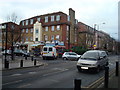
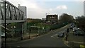


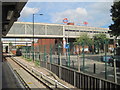
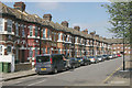


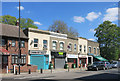
99 photos from this area
Area Information
Key information about the E13 0DR including its size, population, and administrative classification.
- Area Type
- Postcode
- Area Size
- 5.0 hectares
- Population
- 1868
- Population Density
- 8010 people/km²
House Prices in E13 0DR
45
Properties
£266,727
Average Sold Price
£38,000
Lowest Price
£700,000
Highest Price
Showing 45 properties
| Address | Type | Beds | Baths | Last Sale Price | Last Sale Date | |
|---|---|---|---|---|---|---|
| 76 Emma Road, Plaistow, London, E13 0DR | Detached | 2 | 1 | £410,000 | Mar 2025 | |
| 4 Emma Road, Plaistow, London, E13 0DR | house | - | - | £430,000 | Jan 2025 | |
| 108 Emma Road, Plaistow, London, E13 0DR | Semi-detached | 3 | 1 | £700,000 | Apr 2024 | |
| 88 Emma Road, Plaistow, London, E13 0DR | Terraced | 2 | 1 | £425,000 | Jan 2024 | |
| 106 Emma Road, Plaistow, London, E13 0DR | Bungalow | 2 | 1 | £425,000 | Jan 2023 | |
| 80 Emma Road, Plaistow, London, E13 0DR | Terraced | 2 | 1 | £380,000 | Jun 2022 | |
| 6 Emma Road, Plaistow, London, E13 0DR | Terraced | 3 | 1 | £400,000 | May 2022 | |
| 74 Emma Road, Plaistow, London, E13 0DR | house | 2 | 1 | £290,500 | Mar 2022 | |
| 118 Emma Road, Plaistow, London, E13 0DR | Bungalow | 2 | 1 | £417,500 | Jun 2021 | |
| 100 Emma Road, Plaistow, London, E13 0DR | Bungalow | - | - | £325,000 | Mar 2021 |
Page 1 of 5
Energy Efficiency in E13 0DR
Amenities
Schools
| Rank | School | Type | Entry gender | Ages |
|---|
Explore more schools in this area
Go to Schools tabDemographics
Household Size
Family (3-5 people)
most common
Accommodation Type
Flats
most common
Tenure
25
majority
Ethnic Group
White
most common
Religion
N/A
most common
Household Composition
N/A
most common
Age
47
median
Adults (30-64 years)
most common
Household Deprivation
N/A
with no deprivation
NS-SEC
22
in Lower managerial occupations
Explore more demographic insights in this area
Go to Demographics tabPlanning
Planning Constraints
- Flood RiskPremium
- Ramsar Wetland SitesPremium
- Area of Outstanding Natural BeautyPremium
- Protected Nature ReservePremium
- Protected WoodlandPremium