Area Overview for E13 0DA
Photos of E13 0DA
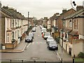
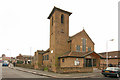

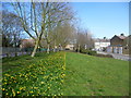
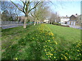
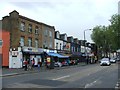
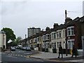
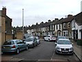
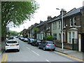
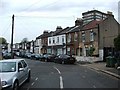
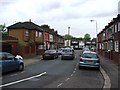
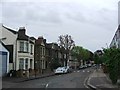
80 photos from this area
Area Information
Key information about the E13 0DA including its size, population, and administrative classification.
- Area Type
- Postcode
- Area Size
- 3358 m²
- Population
- 1830
- Population Density
- 15776 people/km²
House Prices in E13 0DA
33
Properties
£268,389
Average Sold Price
£38,500
Lowest Price
£532,500
Highest Price
Showing 33 properties
| Address | Type | Beds | Baths | Last Sale Price | Last Sale Date | |
|---|---|---|---|---|---|---|
| 105 London Road, Plaistow, London, E13 0DA | Terraced | 4 | 2 | £532,500 | Oct 2022 | |
| 97 London Road, Plaistow, London, E13 0DA | house | - | - | £416,000 | Mar 2022 | |
| 107 London Road, Plaistow, London, E13 0DA | Flat | 3 | 2 | £325,000 | Apr 2021 | |
| 93 London Road, Plaistow, London, E13 0DA | house | - | - | £474,000 | Apr 2019 | |
| 103 London Road, Plaistow, London, E13 0DA | house | - | - | £335,000 | Jul 2015 | |
| 115 London Road, Plaistow, London, E13 0DA | Terraced | - | - | £135,000 | Sep 2000 | |
| 81 London Road, Plaistow, London, E13 0DA | house | 3 | - | £65,500 | Apr 1997 | |
| 113 London Road, Plaistow, London, E13 0DA | undefined | - | - | £94,000 | Dec 1996 | |
| 117 London Road, Plaistow, London, E13 0DA | Terraced | - | - | £38,500 | Jul 1995 | |
| 91 London Road, Plaistow, London, E13 0DA | Terraced | 3 | - | - | - |
Page 1 of 4
Energy Efficiency in E13 0DA
Amenities
Schools
| Rank | School | Type | Entry gender | Ages |
|---|
Explore more schools in this area
Go to Schools tabDemographics
Household Size
Family (3-5 people)
most common
Accommodation Type
Houses
most common
Tenure
38
majority
Ethnic Group
asian_total
most common
Religion
N/A
most common
Household Composition
N/A
most common
Age
47
median
Adults (30-64 years)
most common
Household Deprivation
N/A
with no deprivation
NS-SEC
20
in Lower managerial occupations
Explore more demographic insights in this area
Go to Demographics tabPlanning
Planning Constraints
- Flood RiskPremium
- Ramsar Wetland SitesPremium
- Area of Outstanding Natural BeautyPremium
- Protected Nature ReservePremium
- Protected WoodlandPremium