Area Overview for E13 0BZ
Photos of E13 0BZ
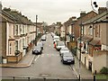
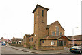

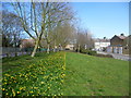
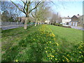
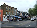
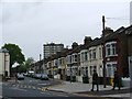
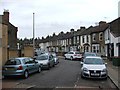
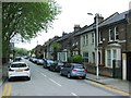
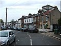
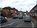
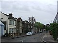
80 photos from this area
Area Information
Key information about the E13 0BZ including its size, population, and administrative classification.
- Area Type
- Postcode
- Area Size
- 9337 m²
- Population
- 1810
- Population Density
- 19568 people/km²
House Prices in E13 0BZ
92
Properties
£229,241
Average Sold Price
£60,000
Lowest Price
£460,000
Highest Price
Showing 92 properties
| Address | Type | Beds | Baths | Last Sale Price | Last Sale Date | |
|---|---|---|---|---|---|---|
| 41 Chesterton Terrace, Plaistow, London, E13 0BZ | house | - | - | £425,000 | Jan 2025 | |
| 82 Chesterton Terrace, Plaistow, London, E13 0BZ | house | 4 | 1 | £415,000 | Oct 2024 | |
| 70 Chesterton Terrace, Plaistow, London, E13 0BZ | Terraced | 3 | 1 | £450,000 | Jun 2024 | |
| 51A Chesterton Terrace, Plaistow, London, E13 0BZ | Flat | - | - | £295,000 | Feb 2024 | |
| 51B Chesterton Terrace, Plaistow, London, E13 0BZ | Flat | - | - | £319,000 | Feb 2024 | |
| 88 Chesterton Terrace, Plaistow, London, E13 0BZ | Terraced | 4 | 2 | £445,000 | Dec 2022 | |
| 55 Chesterton Terrace, Plaistow, London, E13 0BZ | Flat | - | - | £282,000 | Nov 2022 | |
| 102 Chesterton Terrace, Plaistow, London, E13 0BZ | Terraced | 3 | 2 | £420,000 | Oct 2022 | |
| 57 Chesterton Terrace, Plaistow, London, E13 0BZ | Flat | - | - | £330,000 | Jun 2021 | |
| 60 Chesterton Terrace, Plaistow, London, E13 0BZ | house | - | - | £460,000 | Jun 2021 |
Page 1 of 10
Energy Efficiency in E13 0BZ
Amenities
Schools
| Rank | School | Type | Entry gender | Ages |
|---|
Explore more schools in this area
Go to Schools tabDemographics
Household Size
One person
most common
Accommodation Type
Flats
most common
Tenure
24
majority
Ethnic Group
White
most common
Religion
N/A
most common
Household Composition
N/A
most common
Age
47
median
Adults (30-64 years)
most common
Household Deprivation
N/A
with no deprivation
NS-SEC
20
in Lower managerial occupations
Explore more demographic insights in this area
Go to Demographics tabPlanning
Planning Constraints
- Flood RiskPremium
- Ramsar Wetland SitesPremium
- Area of Outstanding Natural BeautyPremium
- Protected Nature ReservePremium
- Protected WoodlandPremium