Area Overview for E12 6PT
Photos of E12 6PT


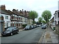


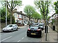
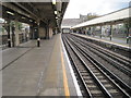
79 photos from this area
Area Information
Key information about the E12 6PT including its size, population, and administrative classification.
- Area Type
- Postcode
- Area Size
- 9801 m²
- Population
- 1893
- Population Density
- 15700 people/km²
House Prices in E12 6PT
57
Properties
£243,119
Average Sold Price
£54,000
Lowest Price
£495,000
Highest Price
Showing 57 properties
| Address | Type | Beds | Baths | Last Sale Price | Last Sale Date | |
|---|---|---|---|---|---|---|
| 107 Rosebery Avenue, Manor Park, London, E12 6PT | Retail | 3 | 2 | £495,000 | May 2022 | |
| 115 Rosebery Avenue, Manor Park, London, E12 6PT | house | - | - | £475,000 | Nov 2021 | |
| 143 Rosebery Avenue, Manor Park, London, E12 6PT | Terraced | 5 | 1 | £450,000 | Nov 2019 | |
| 147 Rosebery Avenue, Manor Park, London, E12 6PT | Terraced | 3 | 1 | £392,500 | Jan 2019 | |
| 167 Rosebery Avenue, Manor Park, London, E12 6PT | Terraced | 3 | 1 | £416,000 | Sep 2018 | |
| 163 Rosebery Avenue, Manor Park, London, E12 6PT | Terraced | 3 | - | £416,752 | Apr 2018 | |
| 161 Rosebery Avenue, Manor Park, London, E12 6PT | Terraced | 2 | - | £280,000 | Nov 2017 | |
| 121 Rosebery Avenue, Manor Park, London, E12 6PT | Terraced | 3 | 1 | £303,000 | Feb 2014 | |
| 125 Rosebery Avenue, Manor Park, London, E12 6PT | Terraced | 3 | - | £225,000 | Oct 2011 | |
| 165 Rosebery Avenue, Manor Park, London, E12 6PT | Terraced | 1 | 1 | £268,500 | Aug 2007 |
Page 1 of 6
Energy Efficiency in E12 6PT
Amenities
Schools
| Rank | School | Type | Entry gender | Ages |
|---|
Explore more schools in this area
Go to Schools tabDemographics
Household Size
Family (3-5 people)
most common
Accommodation Type
Houses
most common
Tenure
53
majority
Ethnic Group
asian_total
most common
Religion
N/A
most common
Household Composition
N/A
most common
Age
47
median
Adults (30-64 years)
most common
Household Deprivation
N/A
with no deprivation
NS-SEC
20
in Lower managerial occupations
Explore more demographic insights in this area
Go to Demographics tabPlanning
Planning Constraints
- Flood RiskPremium
- Ramsar Wetland SitesPremium
- Area of Outstanding Natural BeautyPremium
- Protected Nature ReservePremium
- Protected WoodlandPremium