Area Overview for E11 2DE
Photos of E11 2DE
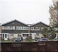
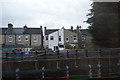
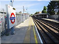
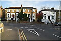
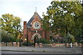
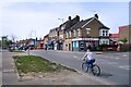
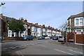
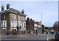
37 photos from this area
Area Information
Key information about the E11 2DE including its size, population, and administrative classification.
- Area Type
- Postcode
- Area Size
- 1.4 hectares
- Population
- 1934
- Population Density
- 7546 people/km²
House Prices in E11 2DE
39
Properties
£513,290
Average Sold Price
£85,000
Lowest Price
£1,344,040
Highest Price
Showing 39 properties
| Address | Type | Beds | Baths | Last Sale Price | Last Sale Date | |
|---|---|---|---|---|---|---|
| 6 Rodney Road, Wanstead, London, E11 2DE | Terraced | 3 | 1 | £600,000 | Aug 2025 | |
| 42 Rodney Road, Wanstead, London, E11 2DE | Semi-detached | 3 | 2 | £1,344,040 | Dec 2022 | |
| 60 Rodney Road, Wanstead, London, E11 2DE | house | - | - | £980,000 | Nov 2022 | |
| 19 Rodney Road, Wanstead, London, E11 2DE | Terraced | 3 | 1 | £761,000 | Oct 2020 | |
| 5 Rodney Road, Wanstead, London, E11 2DE | house | 4 | 2 | £690,000 | Oct 2018 | |
| 50 Rodney Road, Wanstead, London, E11 2DE | Detached | 3 | 2 | £720,000 | Sep 2017 | |
| 12 Rodney Road, Wanstead, London, E11 2DE | house | - | - | £533,000 | Nov 2016 | |
| 11 Rodney Road, Wanstead, London, E11 2DE | house | - | - | £840,000 | Aug 2016 | |
| 7 Rodney Road, Wanstead, London, E11 2DE | house | - | - | £670,000 | May 2016 | |
| 1 Rodney Road, Wanstead, London, E11 2DE | Terraced | 3 | 1 | £905,999 | Jan 2016 |
Page 1 of 4
Energy Efficiency in E11 2DE
Amenities
Schools
| Rank | School | Type | Entry gender | Ages |
|---|
Explore more schools in this area
Go to Schools tabDemographics
Household Size
Family (3-5 people)
most common
Accommodation Type
Houses
most common
Tenure
60
majority
Ethnic Group
White
most common
Religion
N/A
most common
Household Composition
N/A
most common
Age
47
median
Adults (30-64 years)
most common
Household Deprivation
N/A
with no deprivation
NS-SEC
56
in Lower managerial occupations
Explore more demographic insights in this area
Go to Demographics tabPlanning
Planning Constraints
- Flood RiskPremium
- Ramsar Wetland SitesPremium
- Area of Outstanding Natural BeautyPremium
- Protected Nature ReservePremium
- Protected WoodlandPremium