Area Overview for E11 2BJ
Photos of E11 2BJ
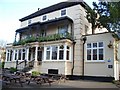
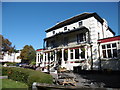
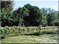
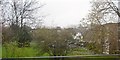
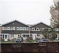
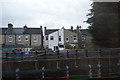
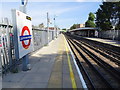
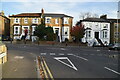

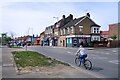
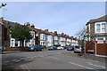
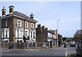
37 photos from this area
Area Information
Key information about the E11 2BJ including its size, population, and administrative classification.
- Area Type
- Postcode
- Area Size
- 7422 m²
- Population
- 1934
- Population Density
- 7546 people/km²
House Prices in E11 2BJ
23
Properties
£662,500
Average Sold Price
£92,500
Lowest Price
£1,065,000
Highest Price
Showing 23 properties
| Address | Type | Beds | Baths | Last Sale Price | Last Sale Date | |
|---|---|---|---|---|---|---|
| 85 Cranbourne Avenue, Wanstead, London, E11 2BJ | house | - | - | £830,000 | Feb 2024 | |
| 63 Cranbourne Avenue, Wanstead, London, E11 2BJ | Terraced | 4 | 2 | £1,065,000 | Jun 2023 | |
| 83 Cranbourne Avenue, Wanstead, London, E11 2BJ | Terraced | 3 | 1 | £850,000 | Jan 2023 | |
| 61 Cranbourne Avenue, Wanstead, London, E11 2BJ | Retail | 4 | 2 | £965,000 | Oct 2022 | |
| 93 Cranbourne Avenue, Wanstead, London, E11 2BJ | Terraced | 4 | 2 | £870,000 | May 2021 | |
| 91 Cranbourne Avenue, Wanstead, London, E11 2BJ | house | - | - | £902,500 | May 2021 | |
| 87 Cranbourne Avenue, Wanstead, London, E11 2BJ | Terraced | 4 | 2 | £841,000 | Oct 2018 | |
| 53 Cranbourne Avenue, Wanstead, London, E11 2BJ | house | - | - | £700,000 | Aug 2016 | |
| 67 Cranbourne Avenue, Wanstead, London, E11 2BJ | house | - | - | £800,000 | Aug 2016 | |
| 89 Cranbourne Avenue, Wanstead, London, E11 2BJ | house | - | - | £580,000 | Mar 2016 |
Page 1 of 3
Energy Efficiency in E11 2BJ
Amenities
Schools
| Rank | School | Type | Entry gender | Ages |
|---|
Explore more schools in this area
Go to Schools tabDemographics
Household Size
Family (3-5 people)
most common
Accommodation Type
Houses
most common
Tenure
60
majority
Ethnic Group
White
most common
Religion
N/A
most common
Household Composition
N/A
most common
Age
47
median
Adults (30-64 years)
most common
Household Deprivation
N/A
with no deprivation
NS-SEC
56
in Lower managerial occupations
Explore more demographic insights in this area
Go to Demographics tabPlanning
Planning Constraints
- Flood RiskPremium
- Ramsar Wetland SitesPremium
- Area of Outstanding Natural BeautyPremium
- Protected Nature ReservePremium
- Protected WoodlandPremium