Area Overview for DA8 3LY
Photos of DA8 3LY
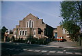
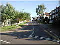
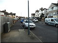
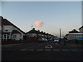
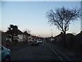
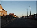
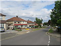
31 photos from this area
Area Information
Key information about the DA8 3LY including its size, population, and administrative classification.
- Area Type
- Postcode
- Area Size
- 9094 m²
- Population
- 1727
- Population Density
- 6490 people/km²
House Prices in DA8 3LY
22
Properties
£273,624
Average Sold Price
£79,000
Lowest Price
£550,000
Highest Price
Showing 22 properties
| Address | Type | Beds | Baths | Last Sale Price | Last Sale Date | |
|---|---|---|---|---|---|---|
| 16 Heath Way, Erith, DA8 3LY | house | - | - | £550,000 | Apr 2023 | |
| 26 Heath Way, Erith, DA8 3LY | house | - | - | £490,000 | Mar 2021 | |
| 44 Heath Way, Erith, DA8 3LY | Semi-detached | 4 | 2 | £425,000 | Oct 2020 | |
| 38 Heath Way, Erith, DA8 3LY | Terraced | 2 | 1 | £317,500 | Mar 2020 | |
| 14 Heath Way, Erith, DA8 3LY | Semi-detached | 4 | 2 | £425,000 | Aug 2019 | |
| 18 Heath Way, Erith, DA8 3LY | Semi-detached | 3 | - | £400,000 | Jul 2017 | |
| 28 Heath Way, Erith, DA8 3LY | Semi-detached | 3 | 1 | £355,000 | Jan 2017 | |
| 22 Heath Way, Erith, DA8 3LY | Semi-detached | 2 | 1 | £280,500 | Apr 2015 | |
| 30 Heath Way, Erith, DA8 3LY | Terraced | - | - | £200,000 | Aug 2012 | |
| 20 Heath Way, Erith, DA8 3LY | Semi-detached | 4 | 2 | £240,000 | Jun 2012 |
Page 1 of 3
Energy Efficiency in DA8 3LY
Amenities
Schools
| Rank | School | Type | Entry gender | Ages |
|---|
Explore more schools in this area
Go to Schools tabDemographics
Household Size
Family (3-5 people)
most common
Accommodation Type
Houses
most common
Tenure
83
majority
Ethnic Group
White
most common
Religion
N/A
most common
Household Composition
N/A
most common
Age
47
median
Adults (30-64 years)
most common
Household Deprivation
N/A
with no deprivation
NS-SEC
31
in Lower managerial occupations
Explore more demographic insights in this area
Go to Demographics tabPlanning
Planning Constraints
- Flood RiskPremium
- Ramsar Wetland SitesPremium
- Area of Outstanding Natural BeautyPremium
- Protected Nature ReservePremium
- Protected WoodlandPremium