Area Overview for DA8 3NF
Photos of DA8 3NF
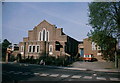
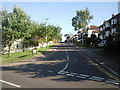
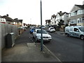
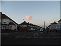
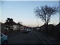
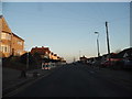
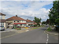
31 photos from this area
Area Information
Key information about the DA8 3NF including its size, population, and administrative classification.
- Area Type
- Postcode
- Area Size
- 6575 m²
- Population
- 1558
- Population Density
- 4784 people/km²
House Prices in DA8 3NF
14
Properties
£261,950
Average Sold Price
£65,000
Lowest Price
£450,000
Highest Price
Showing 14 properties
| Address | Type | Beds | Baths | Last Sale Price | Last Sale Date | |
|---|---|---|---|---|---|---|
| 43 Barnehurst Avenue, Erith, DA8 3NF | Terraced | 3 | 1 | £336,000 | Nov 2023 | |
| 31 Barnehurst Avenue, Erith, DA8 3NF | Terraced | 3 | 1 | £386,000 | Feb 2023 | |
| 25 Barnehurst Avenue, Erith, DA8 3NF | Semi-detached | 4 | - | £450,000 | May 2021 | |
| 22 Barnehurst Avenue, Erith, DA8 3NF | house | - | - | £300,000 | Apr 2018 | |
| 41 Barnehurst Avenue, Erith, DA8 3NF | Terraced | 3 | 1 | £341,500 | Dec 2015 | |
| 27 Barnehurst Avenue, Erith, DA8 3NF | house | - | - | £320,000 | Feb 2015 | |
| 24 Barnehurst Avenue, Erith, DA8 3NF | house | 3 | - | £245,000 | Jan 2012 | |
| 39 Barnehurst Avenue, Erith, DA8 3NF | house | - | - | £160,000 | Jan 2009 | |
| 37 Barnehurst Avenue, Erith, DA8 3NF | Terraced | - | - | £200,000 | May 2008 | |
| 33 Barnehurst Avenue, Erith, DA8 3NF | Terraced | - | - | £77,950 | Jul 1998 |
Page 1 of 2
Energy Efficiency in DA8 3NF
Amenities
Schools
| Rank | School | Type | Entry gender | Ages |
|---|
Explore more schools in this area
Go to Schools tabDemographics
Household Size
Family (3-5 people)
most common
Accommodation Type
Houses
most common
Tenure
81
majority
Ethnic Group
White
most common
Religion
N/A
most common
Household Composition
N/A
most common
Age
47
median
Adults (30-64 years)
most common
Household Deprivation
N/A
with no deprivation
NS-SEC
38
in Lower managerial occupations
Explore more demographic insights in this area
Go to Demographics tabPlanning
Planning Constraints
- Flood RiskPremium
- Ramsar Wetland SitesPremium
- Area of Outstanding Natural BeautyPremium
- Protected Nature ReservePremium
- Protected WoodlandPremium