Area Overview for DA8 3JF
Photos of DA8 3JF

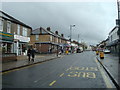


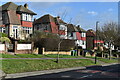
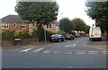

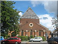
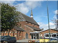
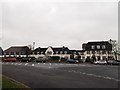
30 photos from this area
Area Information
Key information about the DA8 3JF including its size, population, and administrative classification.
- Area Type
- Postcode
- Area Size
- 1.2 hectares
- Population
- 1689
- Population Density
- 7366 people/km²
House Prices in DA8 3JF
43
Properties
£208,800
Average Sold Price
£74,000
Lowest Price
£370,000
Highest Price
Showing 43 properties
| Address | Type | Beds | Baths | Last Sale Price | Last Sale Date | |
|---|---|---|---|---|---|---|
| 76 Birling Road, Erith, DA8 3JF | Semi-detached | 3 | 1 | £370,000 | Jan 2025 | |
| 18 Birling Road, Erith, DA8 3JF | Detached | 3 | 2 | £293,000 | Sep 2023 | |
| 66 Birling Road, Erith, DA8 3JF | house | - | - | £370,000 | Sep 2021 | |
| 54 Birling Road, Erith, DA8 3JF | Semi-detached | 3 | 1 | £215,000 | Jun 2018 | |
| 80 Birling Road, Erith, DA8 3JF | Semi-detached | 3 | - | £245,000 | Oct 2014 | |
| 78 Birling Road, Erith, DA8 3JF | house | - | - | £172,500 | Mar 2006 | |
| 64 Birling Road, Erith, DA8 3JF | house | - | - | £173,995 | Sep 2005 | |
| 52 Birling Road, Erith, DA8 3JF | house | - | - | £90,000 | Jan 2004 | |
| 40 Birling Road, Erith, DA8 3JF | house | - | - | £84,500 | Aug 2003 | |
| 34 Birling Road, Erith, DA8 3JF | house | - | - | £74,000 | Dec 2002 |
Page 1 of 5
Energy Efficiency in DA8 3JF
Amenities
Schools
| Rank | School | Type | Entry gender | Ages |
|---|
Explore more schools in this area
Go to Schools tabDemographics
Household Size
Family (3-5 people)
most common
Accommodation Type
Houses
most common
Tenure
59
majority
Ethnic Group
White
most common
Religion
N/A
most common
Household Composition
N/A
most common
Age
47
median
Adults (30-64 years)
most common
Household Deprivation
N/A
with no deprivation
NS-SEC
27
in Lower managerial occupations
Explore more demographic insights in this area
Go to Demographics tabPlanning
Planning Constraints
- Flood RiskPremium
- Ramsar Wetland SitesPremium
- Area of Outstanding Natural BeautyPremium
- Protected Nature ReservePremium
- Protected WoodlandPremium