Area Overview for DA8 3PB
Photos of DA8 3PB
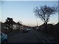
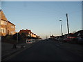
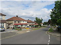
31 photos from this area
Area Information
Key information about the DA8 3PB including its size, population, and administrative classification.
- Area Type
- Postcode
- Area Size
- 2.9 hectares
- Population
- 1727
- Population Density
- 6490 people/km²
House Prices in DA8 3PB
11
Properties
£317,165
Average Sold Price
£189,995
Lowest Price
£449,000
Highest Price
Showing 11 properties
| Address | Type | Beds | Baths | Last Sale Price | Last Sale Date | |
|---|---|---|---|---|---|---|
| North Wode, Colyers Lane, Erith, DA8 3PB | Detached | 4 | 2 | £449,000 | Sep 2021 | |
| 133 Colyers Lane, Erith, DA8 3PB | house | - | - | £312,500 | Apr 2018 | |
| 131 Colyers Lane, Erith, DA8 3PB | house | - | - | £189,995 | Feb 2007 | |
| 137A Colyers Lane, Erith, DA8 3PB | Terraced | 3 | 1 | - | - | |
| 139A Colyers Lane, Erith, DA8 3PB | Flat | 3 | - | - | - | |
| 141A Colyers Lane, Erith, DA8 3PB | Flat | - | - | - | - | |
| 145A Colyers Lane, Erith, DA8 3PB | Flat | - | - | - | - | |
| School House, Colyers Lane, Erith, DA8 3PB | house | - | - | - | - | |
| Heathfield Court Care Home, 147 Colyers Lane, Erith, DA8 3PB | hospital_care_home | - | - | - | - | |
| 135 Colyers Lane, Erith, DA8 3PB | house | - | - | - | - |
Page 1 of 2
Energy Efficiency in DA8 3PB
Amenities
Schools
| Rank | School | Type | Entry gender | Ages |
|---|
Explore more schools in this area
Go to Schools tabDemographics
Household Size
Family (3-5 people)
most common
Accommodation Type
Houses
most common
Tenure
83
majority
Ethnic Group
White
most common
Religion
N/A
most common
Household Composition
N/A
most common
Age
47
median
Adults (30-64 years)
most common
Household Deprivation
N/A
with no deprivation
NS-SEC
31
in Lower managerial occupations
Explore more demographic insights in this area
Go to Demographics tabPlanning
Planning Constraints
- Flood RiskPremium
- Ramsar Wetland SitesPremium
- Area of Outstanding Natural BeautyPremium
- Protected Nature ReservePremium
- Protected WoodlandPremium