Area Overview for DA8 2PQ
Photos of DA8 2PQ


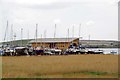
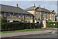
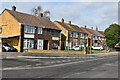


52 photos from this area
Area Information
Key information about the DA8 2PQ including its size, population, and administrative classification.
- Area Type
- Postcode
- Area Size
- 5892 m²
- Population
- 1693
- Population Density
- 5472 people/km²
House Prices in DA8 2PQ
48
Properties
£103,237
Average Sold Price
£24,950
Lowest Price
£229,500
Highest Price
Showing 48 properties
| Address | Type | Beds | Baths | Last Sale Price | Last Sale Date | |
|---|---|---|---|---|---|---|
| 34 Frobisher Road, Erith, DA8 2PQ | Maisonette | 1 | 1 | £111,000 | Apr 2025 | |
| 80 Frobisher Road, Erith, DA8 2PQ | Flat | - | 1 | £99,999 | Mar 2025 | |
| 92 Frobisher Road, Erith, DA8 2PQ | Flat | - | 1 | £120,000 | Jul 2024 | |
| 86 Frobisher Road, Erith, DA8 2PQ | Flat | - | - | £110,000 | Nov 2023 | |
| 26 Frobisher Road, Erith, DA8 2PQ | Flat | 2 | 1 | £229,500 | Aug 2022 | |
| 2 Frobisher Road, Erith, DA8 2PQ | Flat | - | - | £161,000 | Mar 2021 | |
| 8 Frobisher Road, Erith, DA8 2PQ | Flat | - | - | £195,000 | Jun 2020 | |
| 42 Frobisher Road, Erith, DA8 2PQ | Flat | - | - | £85,000 | Feb 2020 | |
| 22 Frobisher Road, Erith, DA8 2PQ | Flat | - | - | £135,000 | Aug 2019 | |
| 94 Frobisher Road, Erith, DA8 2PQ | Flat | - | 1 | £100,000 | May 2019 |
Page 1 of 5
Energy Efficiency in DA8 2PQ
Amenities
Schools
| Rank | School | Type | Entry gender | Ages |
|---|
Explore more schools in this area
Go to Schools tabDemographics
Household Size
Family (3-5 people)
most common
Accommodation Type
Houses
most common
Tenure
35
majority
Ethnic Group
White
most common
Religion
N/A
most common
Household Composition
N/A
most common
Age
47
median
Adults (30-64 years)
most common
Household Deprivation
N/A
with no deprivation
NS-SEC
25
in Lower managerial occupations
Explore more demographic insights in this area
Go to Demographics tabPlanning
Planning Constraints
- Flood RiskPremium
- Ramsar Wetland SitesPremium
- Area of Outstanding Natural BeautyPremium
- Protected Nature ReservePremium
- Protected WoodlandPremium