Area Overview for DA8 1SQ
Photos of DA8 1SQ


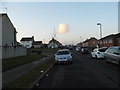


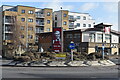
59 photos from this area
Area Information
Key information about the DA8 1SQ including its size, population, and administrative classification.
- Area Type
- Postcode
- Area Size
- 3450 m²
- Population
- Not available
- Population Density
- Not available
House Prices in DA8 1SQ
29
Properties
£131,057
Average Sold Price
£60,750
Lowest Price
£235,000
Highest Price
Showing 29 properties
| Address | Type | Beds | Baths | Last Sale Price | Last Sale Date | |
|---|---|---|---|---|---|---|
| 26 James Watt Way, Erith, DA8 1SQ | Flat | - | - | £99,000 | Apr 2023 | |
| 70 James Watt Way, Erith, DA8 1SQ | Flat | - | - | £235,000 | Dec 2022 | |
| 52 James Watt Way, Erith, DA8 1SQ | Flat | 2 | 1 | £161,250 | Feb 2022 | |
| 18 James Watt Way, Erith, DA8 1SQ | Flat | - | - | £185,000 | Dec 2020 | |
| 40 James Watt Way, Erith, DA8 1SQ | Flat | 2 | 1 | £101,250 | Oct 2019 | |
| 44 James Watt Way, Erith, DA8 1SQ | Flat | - | - | £102,375 | Feb 2019 | |
| 66 James Watt Way, Erith, DA8 1SQ | Flat | - | - | £200,000 | Oct 2017 | |
| 64 James Watt Way, Erith, DA8 1SQ | Flat | - | - | £105,000 | May 2016 | |
| 30 James Watt Way, Erith, DA8 1SQ | Flat | - | - | £60,750 | Apr 2014 | |
| 48 James Watt Way, Erith, DA8 1SQ | Flat | - | - | £78,000 | Dec 2013 |
Page 1 of 3
Energy Efficiency in DA8 1SQ
Amenities
Schools
| Rank | School | Type | Entry gender | Ages |
|---|
Explore more schools in this area
Go to Schools tabDemographics
Household Size
One person
most common
Accommodation Type
Flats
most common
Tenure
45
majority
Ethnic Group
White
most common
Religion
N/A
most common
Household Composition
N/A
most common
Age
47
median
Adults (30-64 years)
most common
Household Deprivation
N/A
with no deprivation
NS-SEC
28
in Lower managerial occupations
Explore more demographic insights in this area
Go to Demographics tabPlanning
Planning Constraints
- Flood RiskPremium
- Ramsar Wetland SitesPremium
- Area of Outstanding Natural BeautyPremium
- Protected Nature ReservePremium
- Protected WoodlandPremium