Area Overview for DA8 1ET
Photos of DA8 1ET

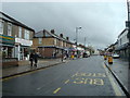


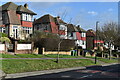
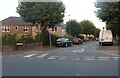

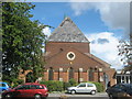
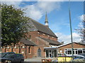
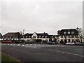
30 photos from this area
Area Information
Key information about the DA8 1ET including its size, population, and administrative classification.
- Area Type
- Postcode
- Area Size
- 7121 m²
- Population
- Not available
- Population Density
- Not available
House Prices in DA8 1ET
21
Properties
£386,337
Average Sold Price
£189,000
Lowest Price
£515,000
Highest Price
Showing 21 properties
| Address | Type | Beds | Baths | Last Sale Price | Last Sale Date | |
|---|---|---|---|---|---|---|
| 21 Vicarage Close, Erith, DA8 1ET | Semi-detached | 4 | 1 | £491,875 | Apr 2025 | |
| 17 Vicarage Close, Erith, DA8 1ET | Semi-detached | 4 | 2 | £515,000 | Feb 2025 | |
| 7 Vicarage Close, Erith, DA8 1ET | Detached | 4 | 1 | £507,000 | Jun 2024 | |
| 16 Vicarage Close, Erith, DA8 1ET | Semi-detached | 4 | 2 | £455,000 | Sep 2023 | |
| 1 Vicarage Close, Erith, DA8 1ET | Retail | 4 | 1 | £480,000 | Apr 2022 | |
| 5 Vicarage Close, Erith, DA8 1ET | house | - | - | £415,000 | Oct 2020 | |
| 10 Vicarage Close, Erith, DA8 1ET | Semi-detached | 3 | 1 | £408,000 | Nov 2016 | |
| 9 Vicarage Close, Erith, DA8 1ET | house | - | - | £390,000 | May 2016 | |
| 4 Vicarage Close, Erith, DA8 1ET | Semi-detached | 4 | 1 | £322,500 | Nov 2015 | |
| 15 Vicarage Close, Erith, DA8 1ET | Semi-detached | 4 | 2 | £335,000 | May 2015 |
Page 1 of 3
Energy Efficiency in DA8 1ET
Amenities
Schools
| Rank | School | Type | Entry gender | Ages |
|---|
Explore more schools in this area
Go to Schools tabDemographics
Household Size
Family (3-5 people)
most common
Accommodation Type
Houses
most common
Tenure
77
majority
Ethnic Group
White
most common
Religion
N/A
most common
Household Composition
N/A
most common
Age
47
median
Adults (30-64 years)
most common
Household Deprivation
N/A
with no deprivation
NS-SEC
37
in Lower managerial occupations
Explore more demographic insights in this area
Go to Demographics tabPlanning
Planning Constraints
- Flood RiskPremium
- Ramsar Wetland SitesPremium
- Area of Outstanding Natural BeautyPremium
- Protected Nature ReservePremium
- Protected WoodlandPremium