Area Overview for DA8 3SP
Photos of DA8 3SP

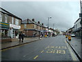


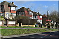
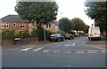

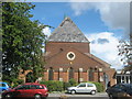
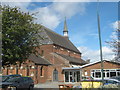
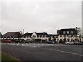
30 photos from this area
Area Information
Key information about the DA8 3SP including its size, population, and administrative classification.
- Area Type
- Postcode
- Area Size
- 5.2 hectares
- Population
- Not available
- Population Density
- Not available
House Prices in DA8 3SP
60
Properties
£335,242
Average Sold Price
£135,000
Lowest Price
£550,000
Highest Price
Showing 60 properties
| Address | Type | Beds | Baths | Last Sale Price | Last Sale Date | |
|---|---|---|---|---|---|---|
| 84 Bexley Road, Erith, DA8 3SP | Terraced | 4 | 2 | £500,000 | Aug 2025 | |
| 124 Bexley Road, Erith, DA8 3SP | Bungalow | 2 | 1 | £330,000 | Apr 2025 | |
| 102 Bexley Road, Erith, DA8 3SP | house | - | - | £470,000 | Sep 2024 | |
| 114 Bexley Road, Erith, DA8 3SP | Semi-detached | 2 | 1 | £435,000 | Jul 2024 | |
| 100 Bexley Road, Erith, DA8 3SP | Semi-detached | 4 | 1 | £450,000 | Apr 2024 | |
| 92 Bexley Road, Erith, DA8 3SP | house | - | - | £300,000 | Mar 2024 | |
| 74 Bexley Road, Erith, DA8 3SP | Bungalow | 2 | 1 | £387,000 | Jul 2023 | |
| 52 Bexley Road, Erith, DA8 3SP | Detached | 4 | 1 | £535,000 | Aug 2022 | |
| 128 Bexley Road, Erith, DA8 3SP | Bungalow | 4 | - | £550,000 | Mar 2022 | |
| 76 Bexley Road, Erith, DA8 3SP | house | - | - | £428,000 | Aug 2021 |
Page 1 of 6
Energy Efficiency in DA8 3SP
Amenities
Schools
| Rank | School | Type | Entry gender | Ages |
|---|
Explore more schools in this area
Go to Schools tabDemographics
Household Size
Family (3-5 people)
most common
Accommodation Type
Houses
most common
Tenure
77
majority
Ethnic Group
White
most common
Religion
N/A
most common
Household Composition
N/A
most common
Age
47
median
Adults (30-64 years)
most common
Household Deprivation
N/A
with no deprivation
NS-SEC
37
in Lower managerial occupations
Explore more demographic insights in this area
Go to Demographics tabPlanning
Planning Constraints
- Flood RiskPremium
- Ramsar Wetland SitesPremium
- Area of Outstanding Natural BeautyPremium
- Protected Nature ReservePremium
- Protected WoodlandPremium