Area Overview for DA16 2QW
Photos of DA16 2QW


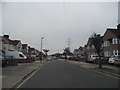

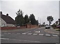
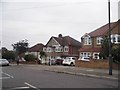
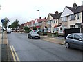
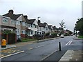
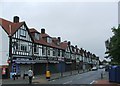
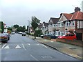
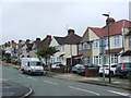
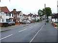
60 photos from this area
Area Information
Key information about the DA16 2QW including its size, population, and administrative classification.
- Area Type
- Postcode
- Area Size
- 1.4 hectares
- Population
- 1465
- Population Density
- 6406 people/km²
House Prices in DA16 2QW
28
Properties
£312,312
Average Sold Price
£93,000
Lowest Price
£590,000
Highest Price
Showing 28 properties
| Address | Type | Beds | Baths | Last Sale Price | Last Sale Date | |
|---|---|---|---|---|---|---|
| 68 Northumberland Avenue, Welling, DA16 2QW | house | - | - | £580,000 | Dec 2025 | |
| 61 Northumberland Avenue, Welling, DA16 2QW | house | - | - | £536,000 | Oct 2020 | |
| 43 Northumberland Avenue, Welling, DA16 2QW | Semi-detached | 5 | 2 | £590,000 | Sep 2019 | |
| 70 Northumberland Avenue, Welling, DA16 2QW | Semi-detached | 3 | - | £315,000 | Nov 2014 | |
| 62 Northumberland Avenue, Welling, DA16 2QW | Semi-detached | 3 | - | £325,000 | Jun 2014 | |
| 76 Northumberland Avenue, Welling, DA16 2QW | Semi-detached | 3 | - | £329,995 | Dec 2013 | |
| 63 Northumberland Avenue, Welling, DA16 2QW | Semi-detached | - | - | £350,000 | Sep 2013 | |
| 60 Northumberland Avenue, Welling, DA16 2QW | house | 4 | - | £352,000 | May 2012 | |
| 58 Northumberland Avenue, Welling, DA16 2QW | house | 5 | - | £315,000 | Jan 2011 | |
| 51 Northumberland Avenue, Welling, DA16 2QW | Semi-detached | - | - | £267,000 | Feb 2006 |
Page 1 of 3
Energy Efficiency in DA16 2QW
Amenities
Schools
| Rank | School | Type | Entry gender | Ages |
|---|
Explore more schools in this area
Go to Schools tabDemographics
Household Size
Family (3-5 people)
most common
Accommodation Type
Houses
most common
Tenure
94
majority
Ethnic Group
White
most common
Religion
N/A
most common
Household Composition
N/A
most common
Age
47
median
Adults (30-64 years)
most common
Household Deprivation
N/A
with no deprivation
NS-SEC
35
in Lower managerial occupations
Explore more demographic insights in this area
Go to Demographics tabPlanning
Planning Constraints
- Flood RiskPremium
- Ramsar Wetland SitesPremium
- Area of Outstanding Natural BeautyPremium
- Protected Nature ReservePremium
- Protected WoodlandPremium