Area Overview for DA16 2QS
Photos of DA16 2QS
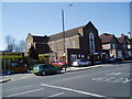
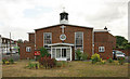
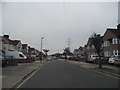
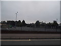
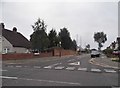
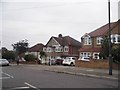
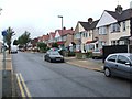
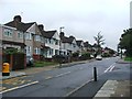
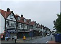
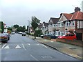
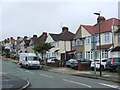
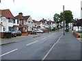
60 photos from this area
Area Information
Key information about the DA16 2QS including its size, population, and administrative classification.
- Area Type
- Postcode
- Area Size
- 8191 m²
- Population
- 1452
- Population Density
- 6627 people/km²
House Prices in DA16 2QS
32
Properties
£244,197
Average Sold Price
£84,500
Lowest Price
£505,000
Highest Price
Showing 32 properties
| Address | Type | Beds | Baths | Last Sale Price | Last Sale Date | |
|---|---|---|---|---|---|---|
| 45 Montrose Avenue, Welling, DA16 2QS | Semi-detached | 5 | 2 | £505,000 | Mar 2024 | |
| 51 Montrose Avenue, Welling, DA16 2QS | house | - | - | £375,000 | Mar 2021 | |
| 57 Montrose Avenue, Welling, DA16 2QS | house | - | - | £345,000 | Oct 2020 | |
| 33 Montrose Avenue, Welling, DA16 2QS | Terraced | 4 | 1 | £325,000 | Oct 2020 | |
| 61 Montrose Avenue, Welling, DA16 2QS | house | 3 | 1 | £347,000 | Jan 2020 | |
| 65 Montrose Avenue, Welling, DA16 2QS | Terraced | 4 | 1 | £382,000 | Oct 2019 | |
| 73 Montrose Avenue, Welling, DA16 2QS | Terraced | - | - | £253,334 | Dec 2017 | |
| 47 Montrose Avenue, Welling, DA16 2QS | Terraced | 3 | - | £360,000 | Dec 2016 | |
| 67 Montrose Avenue, Welling, DA16 2QS | Terraced | 3 | - | £230,000 | Sep 2013 | |
| 37 Montrose Avenue, Welling, DA16 2QS | Terraced | 4 | - | £265,000 | May 2013 |
Page 1 of 4
Energy Efficiency in DA16 2QS
Amenities
Schools
| Rank | School | Type | Entry gender | Ages |
|---|
Explore more schools in this area
Go to Schools tabDemographics
Household Size
Family (3-5 people)
most common
Accommodation Type
Houses
most common
Tenure
90
majority
Ethnic Group
White
most common
Religion
N/A
most common
Household Composition
N/A
most common
Age
47
median
Adults (30-64 years)
most common
Household Deprivation
N/A
with no deprivation
NS-SEC
38
in Lower managerial occupations
Explore more demographic insights in this area
Go to Demographics tabPlanning
Planning Constraints
- Flood RiskPremium
- Ramsar Wetland SitesPremium
- Area of Outstanding Natural BeautyPremium
- Protected Nature ReservePremium
- Protected WoodlandPremium