Area Overview for DA16 2NA
Photos of DA16 2NA
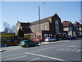
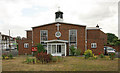
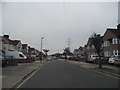
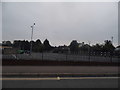
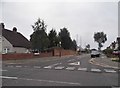
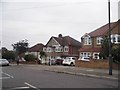
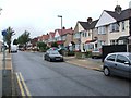
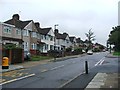
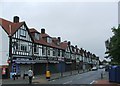
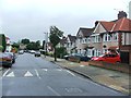
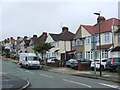
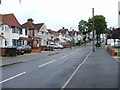
60 photos from this area
Area Information
Key information about the DA16 2NA including its size, population, and administrative classification.
- Area Type
- Postcode
- Area Size
- 5542 m²
- Population
- 1658
- Population Density
- 6084 people/km²
House Prices in DA16 2NA
18
Properties
£237,922
Average Sold Price
£60,000
Lowest Price
£526,000
Highest Price
Showing 18 properties
| Address | Type | Beds | Baths | Last Sale Price | Last Sale Date | |
|---|---|---|---|---|---|---|
| 53 Buckingham Avenue, Welling, DA16 2NA | Terraced | 2 | 1 | £433,000 | Feb 2022 | |
| 61 Buckingham Avenue, Welling, DA16 2NA | Terraced | 3 | 1 | £422,500 | Oct 2021 | |
| 37 Buckingham Avenue, Welling, DA16 2NA | Semi-detached | 5 | 2 | £526,000 | Apr 2020 | |
| 57 Buckingham Avenue, Welling, DA16 2NA | Terraced | 3 | - | £385,000 | Sep 2017 | |
| 71 Buckingham Avenue, Welling, DA16 2NA | house | 3 | - | £363,500 | Oct 2016 | |
| 51 Buckingham Avenue, Welling, DA16 2NA | Terraced | 3 | 1 | £345,000 | Dec 2015 | |
| 41 Buckingham Avenue, Welling, DA16 2NA | Semi-detached | - | - | £231,000 | Mar 2006 | |
| 65 Buckingham Avenue, Welling, DA16 2NA | Terraced | - | - | £196,500 | Nov 2005 | |
| 45 Buckingham Avenue, Welling, DA16 2NA | Semi-detached | 3 | 1 | £187,000 | Jul 2004 | |
| 55 Buckingham Avenue, Welling, DA16 2NA | Terraced | 3 | - | £138,500 | Mar 2002 |
Page 1 of 2
Energy Efficiency in DA16 2NA
Amenities
Schools
| Rank | School | Type | Entry gender | Ages |
|---|
Explore more schools in this area
Go to Schools tabDemographics
Household Size
Family (3-5 people)
most common
Accommodation Type
Houses
most common
Tenure
87
majority
Ethnic Group
White
most common
Religion
N/A
most common
Household Composition
N/A
most common
Age
47
median
Adults (30-64 years)
most common
Household Deprivation
N/A
with no deprivation
NS-SEC
36
in Lower managerial occupations
Explore more demographic insights in this area
Go to Demographics tabPlanning
Planning Constraints
- Flood RiskPremium
- Ramsar Wetland SitesPremium
- Area of Outstanding Natural BeautyPremium
- Protected Nature ReservePremium
- Protected WoodlandPremium