Area Overview for DA16 2HP
Photos of DA16 2HP
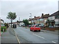
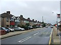
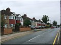
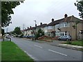
85 photos from this area
Area Information
Key information about the DA16 2HP including its size, population, and administrative classification.
- Area Type
- Postcode
- Area Size
- 9299 m²
- Population
- 1494
- Population Density
- 7814 people/km²
House Prices in DA16 2HP
28
Properties
£270,841
Average Sold Price
£178,500
Lowest Price
£534,000
Highest Price
Showing 28 properties
| Address | Type | Beds | Baths | Last Sale Price | Last Sale Date | |
|---|---|---|---|---|---|---|
| 290 Westwood Lane, Welling, DA16 2HP | Semi-detached | 3 | 1 | £415,000 | Jun 2023 | |
| 294 Westwood Lane, Welling, DA16 2HP | Semi-detached | 5 | 3 | £534,000 | May 2019 | |
| 264 Westwood Lane, Welling, DA16 2HP | Semi-detached | 3 | 1 | £373,000 | Nov 2017 | |
| 244 Westwood Lane, Welling, DA16 2HP | Semi-detached | 3 | - | £317,000 | May 2016 | |
| 266 Westwood Lane, Welling, DA16 2HP | house | 3 | - | £375,000 | Apr 2016 | |
| 270 Westwood Lane, Welling, DA16 2HP | Semi-detached | 3 | 1 | £340,000 | Dec 2015 | |
| 260 Westwood Lane, Welling, DA16 2HP | Semi-detached | 3 | - | £320,000 | Oct 2015 | |
| 296 Westwood Lane, Welling, DA16 2HP | Semi-detached | 3 | - | £232,500 | Jun 2013 | |
| 286 Westwood Lane, Welling, DA16 2HP | Semi-detached | 3 | 1 | £200,000 | Aug 2012 | |
| 298 Westwood Lane, Welling, DA16 2HP | Bungalow | 3 | - | £246,000 | Aug 2011 |
Page 1 of 3
Energy Efficiency in DA16 2HP
Amenities
Schools
| Rank | School | Type | Entry gender | Ages |
|---|
Explore more schools in this area
Go to Schools tabDemographics
Household Size
Family (3-5 people)
most common
Accommodation Type
Houses
most common
Tenure
91
majority
Ethnic Group
White
most common
Religion
N/A
most common
Household Composition
N/A
most common
Age
47
median
Adults (30-64 years)
most common
Household Deprivation
N/A
with no deprivation
NS-SEC
33
in Lower managerial occupations
Explore more demographic insights in this area
Go to Demographics tabPlanning
Planning Constraints
- Flood RiskPremium
- Ramsar Wetland SitesPremium
- Area of Outstanding Natural BeautyPremium
- Protected Nature ReservePremium
- Protected WoodlandPremium