Area Overview for DA16 1RJ
Photos of DA16 1RJ

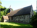

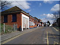

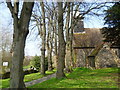
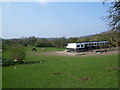
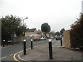
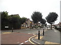
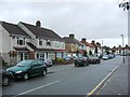
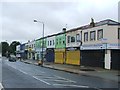
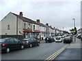
93 photos from this area
Area Information
Key information about the DA16 1RJ including its size, population, and administrative classification.
- Area Type
- Postcode
- Area Size
- 4261 m²
- Population
- 1631
- Population Density
- 7945 people/km²
House Prices in DA16 1RJ
18
Properties
£351,885
Average Sold Price
£165,000
Lowest Price
£445,000
Highest Price
Showing 18 properties
| Address | Type | Beds | Baths | Last Sale Price | Last Sale Date | |
|---|---|---|---|---|---|---|
| 28 Lyme Road, Welling, DA16 1RJ | Semi-detached | 2 | 1 | £409,000 | Oct 2024 | |
| 34 Lyme Road, Welling, DA16 1RJ | Semi-detached | 2 | 1 | £423,500 | Oct 2024 | |
| 2 Lyme Road, Welling, DA16 1RJ | Semi-detached | 2 | 1 | £445,000 | Jun 2024 | |
| 18 Lyme Road, Welling, DA16 1RJ | house | - | - | £412,000 | Aug 2021 | |
| 24 Lyme Road, Welling, DA16 1RJ | house | - | - | £410,000 | Jun 2021 | |
| 14 Lyme Road, Welling, DA16 1RJ | Semi-detached | 3 | 1 | £395,000 | Jan 2021 | |
| 30 Lyme Road, Welling, DA16 1RJ | house | - | - | £425,500 | Dec 2020 | |
| 36 Lyme Road, Welling, DA16 1RJ | Semi-detached | 2 | - | £365,000 | Nov 2020 | |
| 26 Lyme Road, Welling, DA16 1RJ | Semi-detached | 2 | 1 | £338,000 | Nov 2020 | |
| 12 Lyme Road, Welling, DA16 1RJ | Semi-detached | 2 | 1 | £370,000 | Nov 2016 |
Page 1 of 2
Energy Efficiency in DA16 1RJ
Amenities
Schools
| Rank | School | Type | Entry gender | Ages |
|---|
Explore more schools in this area
Go to Schools tabDemographics
Household Size
Family (3-5 people)
most common
Accommodation Type
Houses
most common
Tenure
70
majority
Ethnic Group
White
most common
Religion
N/A
most common
Household Composition
N/A
most common
Age
47
median
Adults (30-64 years)
most common
Household Deprivation
N/A
with no deprivation
NS-SEC
31
in Lower managerial occupations
Explore more demographic insights in this area
Go to Demographics tabPlanning
Planning Constraints
- Flood RiskPremium
- Ramsar Wetland SitesPremium
- Area of Outstanding Natural BeautyPremium
- Protected Nature ReservePremium
- Protected WoodlandPremium