Area Overview for DA14 6LH
Photos of DA14 6LH
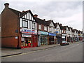
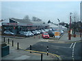
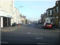
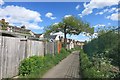
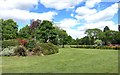
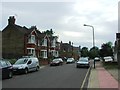
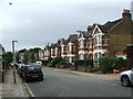
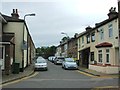
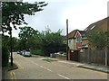
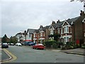
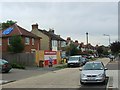
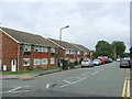
76 photos from this area
Area Information
Key information about the DA14 6LH including its size, population, and administrative classification.
- Area Type
- Postcode
- Area Size
- 2.4 hectares
- Population
- 1902
- Population Density
- 2130 people/km²
House Prices in DA14 6LH
42
Properties
£410,690
Average Sold Price
£90,000
Lowest Price
£750,000
Highest Price
Showing 42 properties
| Address | Type | Beds | Baths | Last Sale Price | Last Sale Date | |
|---|---|---|---|---|---|---|
| Glendale, Durham Road, Sidcup, DA14 6LH | house | 3 | 1 | £380,000 | Aug 2025 | |
| 14 Durham Road, Sidcup, DA14 6LH | Semi-detached | 3 | 1 | £557,500 | Jun 2025 | |
| 9 Durham Road, Sidcup, DA14 6LH | Semi-detached | 3 | 1 | £544,500 | Feb 2025 | |
| 7 Durham Road, Sidcup, DA14 6LH | Detached | 4 | 1 | £750,000 | Dec 2024 | |
| 18 Durham Road, Sidcup, DA14 6LH | house | - | - | £610,000 | Jun 2021 | |
| 26 Durham Road, Sidcup, DA14 6LH | Semi-detached | 3 | 1 | £540,000 | Apr 2021 | |
| 33 Durham Road, Sidcup, DA14 6LH | Detached | 3 | 1 | £438,000 | Mar 2019 | |
| Hazelhurst, Durham Road, Sidcup, DA14 6LH | Semi-detached | 3 | - | £422,500 | Sep 2016 | |
| 1 Durham Road, Sidcup, DA14 6LH | Flat | 3 | 2 | £430,000 | Aug 2016 | |
| 30 Durham Road, Sidcup, DA14 6LH | Semi-detached | 3 | 1 | £495,000 | Mar 2016 |
Page 1 of 5
Energy Efficiency in DA14 6LH
Amenities
Schools
| Rank | School | Type | Entry gender | Ages |
|---|
Explore more schools in this area
Go to Schools tabDemographics
Household Size
One person
most common
Accommodation Type
Flats
most common
Tenure
41
majority
Ethnic Group
White
most common
Religion
N/A
most common
Household Composition
N/A
most common
Age
47
median
Adults (30-64 years)
most common
Household Deprivation
N/A
with no deprivation
NS-SEC
37
in Lower managerial occupations
Explore more demographic insights in this area
Go to Demographics tabPlanning
Planning Constraints
- Flood RiskPremium
- Ramsar Wetland SitesPremium
- Area of Outstanding Natural BeautyPremium
- Protected Nature ReservePremium
- Protected WoodlandPremium