Area Overview for DA14 4PX
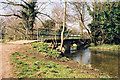
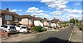
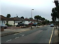
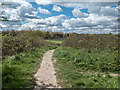
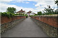
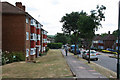
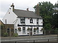
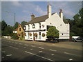
Photos of DA14 4PX


Area Information
Living in DA14 4PX offers a compact, residential experience within the London Borough of Bexley. This small postcode area, spanning 6.2 hectares, is home to 1,617 residents, creating a densely populated yet intimate community. The area’s proximity to St Mary’s & St James electoral ward suggests a connection to local governance and civic engagement. With a median age of 47, the population skews toward adults in their 30s to 60s, reflecting a stable, established demographic. Daily life here balances suburban tranquillity with practical access to transport and amenities. The area’s small size means residents are likely to know their neighbours, fostering a close-knit environment. While the data does not specify historical context, its inclusion in Bexley’s electoral framework hints at a long-standing role in local politics. For buyers, DA14 4PX presents a chance to live in a well-defined, manageable space with clear community boundaries and infrastructure.
- Area Type
- Postcode
- Area Size
- 6.2 hectares
- Population
- 1617
- Population Density
- 786 people/km²
The property market in DA14 4PX is characterised by a 59% home ownership rate, with houses forming the predominant accommodation type. This suggests a focus on family homes and long-term residency rather than a transient rental market. Given the area’s small size, the housing stock is likely limited, which could make it a competitive market for buyers. The high proportion of owner-occupied properties may indicate a community of established residents, potentially reducing turnover and fostering stability. However, the lack of specific data on property prices or types means buyers should consider proximity to amenities and transport when evaluating the area. The presence of multiple rail stations and retail options within reach could enhance the appeal of homes here, particularly for those prioritising connectivity. For investors, the market may offer opportunities in a niche, well-serviced postcode, though the limited size of the area means demand could outstrip supply.
House Prices in DA14 4PX
No properties found in this postcode.
Energy Efficiency in DA14 4PX
Residents of DA14 4PX enjoy a range of amenities within walking or short driving distance. Retail options include Co-op Albany, Lidl Foots, and M&S Bypass BP, providing access to groceries, clothing, and everyday essentials. The area’s transport links—five rail stations, three ferry piers, and four metro stops—enhance convenience for shopping, commuting, and leisure. While specific parks or leisure venues are not listed, the presence of ferry services and proximity to Bexley’s green spaces may offer recreational opportunities. The compact layout means daily errands and social activities can be managed without long journeys. The mix of retail, transport, and nearby airports suggests a lifestyle that prioritises accessibility and practicality. However, the lack of detailed information on local parks or cultural venues means buyers should verify if additional amenities align with their preferences.
Amenities
Schools
Residents of DA14 4PX have access to two primary schools: Royal Park Primary School and Royal Park Primary Academy. Both institutions cater to younger children, though Royal Park Primary Academy holds an Ofsted rating of ‘good’, indicating a higher standard of education. The presence of two primary schools within the area suggests a focus on early education, which may be particularly appealing to families with young children. While no secondary schools are listed, the proximity to Bexley’s broader network of educational institutions could provide additional options. The mix of schools, though limited to primary levels, reflects a community prioritising foundational education. Families may benefit from the convenience of having two primary schools nearby, reducing travel time and offering choices in teaching quality. However, the absence of secondary school data means buyers should investigate further if secondary education is a priority.
| Rank | School | Type | Entry gender | Ages |
|---|
Explore more schools in this area
Go to Schools tabDemographics
DA14 4PX has a median age of 47, with the majority of residents aged between 30 and 64. This suggests a population of working-age adults, many of whom may be in their peak earning years or nearing retirement. Home ownership stands at 59%, indicating a mix of owner-occupied properties and rental units. The accommodation type is predominantly houses, which aligns with the area’s residential character. The predominant ethnic group is White, though no specific diversity statistics are provided. The population density of 786 people per square kilometre is notably high for the area’s size, reflecting a compact, possibly multi-generational living pattern. This density may influence local services and community dynamics, though it does not necessarily correlate with deprivation levels. The data does not specify deprivation metrics, but the high home ownership rate and stable age profile suggest a relatively stable socioeconomic environment.
Household Size
Accommodation Type
Tenure
Ethnic Group
Religion
Household Composition
Age
Household Deprivation
NS-SEC
Explore more demographic insights in this area
Go to Demographics tabPlanning
Planning Constraints
- Flood RiskPremium
- Ramsar Wetland SitesPremium
- Area of Outstanding Natural BeautyPremium
- Protected Nature ReservePremium
- Protected WoodlandPremium