Area Overview for DA14 4PU
Photos of DA14 4PU
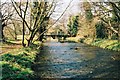
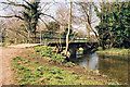

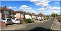
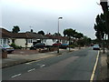
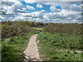
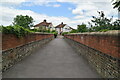
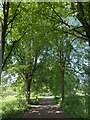
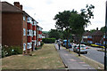
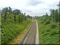
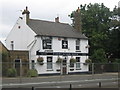
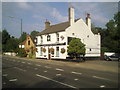
66 photos from this area
Area Information
Key information about the DA14 4PU including its size, population, and administrative classification.
- Area Type
- Postcode
- Area Size
- 13.9 hectares
- Population
- 1617
- Population Density
- 786 people/km²
House Prices in DA14 4PU
53
Properties
£332,107
Average Sold Price
£95,000
Lowest Price
£600,000
Highest Price
Showing 53 properties
| Address | Type | Beds | Baths | Last Sale Price | Last Sale Date | |
|---|---|---|---|---|---|---|
| 2 Riverside Road, Sidcup, DA14 4PU | Semi-detached | 3 | 1 | £540,000 | Apr 2025 | |
| 40 Riverside Road, Sidcup, DA14 4PU | Bungalow | - | - | £420,000 | Mar 2025 | |
| 48 Riverside Road, Sidcup, DA14 4PU | Bungalow | 2 | 1 | £568,000 | Mar 2025 | |
| 8 Riverside Road, Sidcup, DA14 4PU | Semi-detached | 3 | 1 | £560,000 | Sep 2024 | |
| 64 Riverside Road, Sidcup, DA14 4PU | Semi-detached | 3 | 1 | £600,000 | Sep 2024 | |
| 24 Riverside Road, Sidcup, DA14 4PU | Bungalow | 3 | 2 | £505,000 | Aug 2024 | |
| 42 Riverside Road, Sidcup, DA14 4PU | Bungalow | 2 | 1 | £470,000 | Jun 2023 | |
| 32 Riverside Road, Sidcup, DA14 4PU | Semi-detached | 2 | 1 | £410,000 | Jan 2023 | |
| 44 Riverside Road, Sidcup, DA14 4PU | Bungalow | 2 | 1 | £400,000 | Jul 2022 | |
| 26 Riverside Road, Sidcup, DA14 4PU | Bungalow | - | - | £325,000 | Aug 2021 |
Page 1 of 6
Energy Efficiency in DA14 4PU
Amenities
Schools
| Rank | School | Type | Entry gender | Ages |
|---|
Explore more schools in this area
Go to Schools tabDemographics
Household Size
Family (3-5 people)
most common
Accommodation Type
Houses
most common
Tenure
59
majority
Ethnic Group
White
most common
Religion
N/A
most common
Household Composition
N/A
most common
Age
47
median
Adults (30-64 years)
most common
Household Deprivation
N/A
with no deprivation
NS-SEC
29
in Lower managerial occupations
Explore more demographic insights in this area
Go to Demographics tabPlanning
Planning Constraints
- Flood RiskPremium
- Ramsar Wetland SitesPremium
- Area of Outstanding Natural BeautyPremium
- Protected Nature ReservePremium
- Protected WoodlandPremium