Area Overview for DA14 4DE
Photos of DA14 4DE
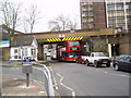
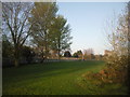
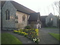
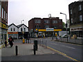
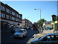

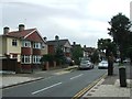
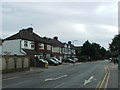
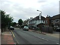
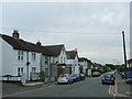
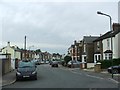
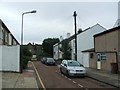
91 photos from this area
Area Information
Key information about the DA14 4DE including its size, population, and administrative classification.
- Area Type
- Postcode
- Area Size
- 8022 m²
- Population
- 2175
- Population Density
- 7306 people/km²
House Prices in DA14 4DE
30
Properties
£346,895
Average Sold Price
£50,000
Lowest Price
£640,000
Highest Price
Showing 30 properties
| Address | Type | Beds | Baths | Last Sale Price | Last Sale Date | |
|---|---|---|---|---|---|---|
| 34 Birkbeck Road, Sidcup, DA14 4DE | Terraced | 3 | 1 | £500,000 | Oct 2025 | |
| 38 Birkbeck Road, Sidcup, DA14 4DE | house | 2 | 1 | £460,000 | Sep 2024 | |
| 24 Birkbeck Road, Sidcup, DA14 4DE | Detached | 3 | 2 | £581,000 | Jul 2024 | |
| 16 Birkbeck Road, Sidcup, DA14 4DE | Semi-detached | 3 | 1 | £605,000 | Apr 2024 | |
| 48 Birkbeck Road, Sidcup, DA14 4DE | Semi-detached | 2 | 1 | £552,500 | Jul 2023 | |
| 42 Birkbeck Road, Sidcup, DA14 4DE | house | 3 | 1 | £495,000 | Apr 2022 | |
| 50 Birkbeck Road, Sidcup, DA14 4DE | house | 2 | - | £510,000 | Feb 2022 | |
| 32 Birkbeck Road, Sidcup, DA14 4DE | house | - | - | £640,000 | Jan 2021 | |
| 2A Birkbeck Road, Sidcup, DA14 4DE | Flat | 3 | 1 | £260,000 | Dec 2019 | |
| 2 Birkbeck Road, Sidcup, DA14 4DE | Flat | 2 | - | £50,000 | Dec 2019 |
Page 1 of 3
Energy Efficiency in DA14 4DE
Amenities
Schools
| Rank | School | Type | Entry gender | Ages |
|---|
Explore more schools in this area
Go to Schools tabDemographics
Household Size
One person
most common
Accommodation Type
Flats
most common
Tenure
55
majority
Ethnic Group
White
most common
Religion
N/A
most common
Household Composition
N/A
most common
Age
47
median
Adults (30-64 years)
most common
Household Deprivation
N/A
with no deprivation
NS-SEC
37
in Lower managerial occupations
Explore more demographic insights in this area
Go to Demographics tabPlanning
Planning Constraints
- Flood RiskPremium
- Ramsar Wetland SitesPremium
- Area of Outstanding Natural BeautyPremium
- Protected Nature ReservePremium
- Protected WoodlandPremium