Area Overview for CR9 2DD
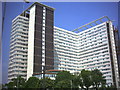
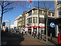
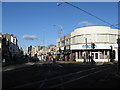
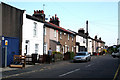
Photos of CR9 2DD


Area Information
Living in CR9 2DD means inhabiting a small, densely populated residential cluster in the London Borough of Croydon. The area covers 354 m² and is home to 2,350 people, translating to an exceptionally high population density of 6,636,257 people per km². This compact postcode is part of a historic suburb with roots in Old English, named for its wooded surroundings. Its proximity to Selhurst railway station and tram stops connects residents to Croydon’s broader network, while nearby primary schools and retail hubs like Co-op and Tesco provide daily convenience. The area’s character blends urban practicality with a sense of local identity, shaped by its 19th-century development and integration into Croydon’s administrative boundaries. For buyers, CR9 2DD offers a snapshot of suburban life in South London, where proximity to transport and amenities balances with the challenges of high density.
- Area Type
- Postcode
- Area Size
- 354 m²
- Population
- Not available
- Population Density
- Not available
CR9 2DD’s property market is characterised by a low home ownership rate (36%) and a predominance of flats. This suggests a rental market where landlords and tenants dominate, with limited opportunities for owner-occupation. The compact size of the postcode means housing stock is concentrated in a small area, potentially limiting availability for buyers seeking larger properties. Flats in this area likely cater to families and professionals prioritising proximity to transport and schools. For buyers, the challenge lies in navigating a competitive rental market, with limited scope for long-term investment in property. The absence of protected land or planning constraints may allow for future development, but the high population density could constrain expansion.
House Prices in CR9 2DD
No properties found in this postcode.
Energy Efficiency in CR9 2DD
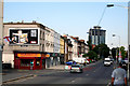
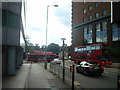
Daily life in CR9 2DD is shaped by its proximity to retail and transport hubs. Nearby, Co-op 61 Lower, Tesco Croydon, and Co-op Selhurst offer grocery and daily essentials, while Selhurst Station and tram stops provide access to wider leisure and employment opportunities. The area’s compact nature means amenities are within practical reach, though the lack of parks or green spaces is notable. Residents can access Croydon’s cultural and commercial centres with ease, balancing convenience with the constraints of high density. The presence of multiple schools and transport links reinforces the area’s appeal for families and professionals seeking accessibility over expansive living space.
Amenities
Schools
CR9 2DD is served by multiple primary schools, including Broadmead Junior School, Broadmead Nursery and Infant School, and Broadmead Primary School. One of these schools holds an Ofsted rating of ‘good’, indicating a reliable standard of education. The concentration of primary schools within the area suggests strong local provision for families with young children. However, the absence of secondary schools means students may need to travel to nearby areas for further education. The mix of school types ensures coverage for different age groups, though parents should consider the need for additional transport arrangements beyond primary level.
| Rank | School | Type | Entry gender | Ages |
|---|
Explore more schools in this area
Go to Schools tabDemographics
CR9 2DD’s population skews towards adults aged 30–64, with a median age of 47. This suggests a community of established professionals and families, rather than a transient or student demographic. Home ownership is relatively low at 36%, indicating a rental market dominated by flats. The area’s predominant ethnic group is White, though no specific diversity metrics are provided. The high population density, while reflecting urban efficiency, may impact living space per person. For quality of life, the lack of protected natural areas or planning constraints suggests minimal restrictions on development, but the area’s safety profile includes a medium crime risk, necessitating standard security measures. These factors shape a community where convenience and accessibility are prioritised, though density can influence local dynamics.
Household Size
Accommodation Type
Tenure
Ethnic Group
Religion
Household Composition
Age
Household Deprivation
NS-SEC
Explore more demographic insights in this area
Go to Demographics tabPlanning
Planning Constraints
- Flood RiskPremium
- Ramsar Wetland SitesPremium
- Area of Outstanding Natural BeautyPremium
- Protected Nature ReservePremium
- Protected WoodlandPremium