Area Overview for CR8 3AB
Photos of CR8 3AB

Area Information
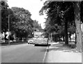
Purley & Woodcote Ward defines the character of CR8 3AB, a small residential cluster established as an electoral ward in 2018. This specific postcode covers merely 1,422 square metres yet houses a population of 1,719 people. You are looking at a location approximately 11.7 miles south of Charing Cross that blends suburban comfort with significant historical depth. The area encompasses Purley high street, Woodcote to the west, Peaks Hill to the north, and borders Purley Oaks, Riddlesdown, Kenley, and Coulsdon. The name Purley itself derives from an Anglo-Saxon estate mentioned around 1200, indicating a clearing where pear trees grew. This ward creates a defined boundary for those wishing to live in a specific, tightly knit section of Greater London. The geography includes the cuverted Bourne river, remnants of the Surrey Iron Railway in Rotary Field, and the historic Webb Estate. Living in CR8 3AB means residing within a zone that successfully connects the past with a modern suburban reality. Its compact size creates a distinct sense of place, separate from the broader Purley postal district while remaining fully integrated into the broader community.
- Area Type
- Postcode
- Area Size
- 1422 m²
- Population
- Not available
- Population Density
- Not available
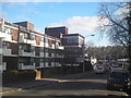
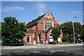
The housing stock in CR8 3AB is almost exclusively composed of houses, mirroring the broader character of the Purley and Woodcote wards. A significant majority of residents own their properties outright or through a mortgage, with home ownership reaching 67%. This statistic confirms that the local market is driven by owner-occupiers rather than investors or landlords seeking short-term yields. When you look at homes in this postcode, you will find a mix of early 20th-century development and garden village styles. The presence of the Webb Estate, with its around 220 Edwardian homes, sets a standard for the architectural quality in the immediate vicinity. Because the area is largely home-occupied, price fluctuations often reflect local family needs and school catchment areas rather than corporate leasing trends. Buyers looking at this small residential cluster can expect a market that values permanence. The high ownership rate suggests few new-entrant investors are flipping properties quickly, leading to a steadier market for serious purchasers.
House Prices in CR8 3AB
Showing 1 properties
| Address | Type | Beds | Baths | Last Sale Price | Last Sale Date | |
|---|---|---|---|---|---|---|
| Purley View Nursing Home, 20 Brighton Road, Purley, CR8 3AB | hospital_care_home | - | - | £3,520,400 | Dec 2017 |
Energy Efficiency in CR8 3AB
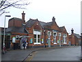
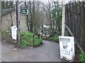
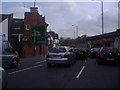
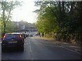
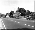
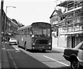
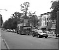
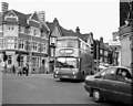
Your daily routine in CR8 3AB is supported by five notable retail venues within practical reach, including Tesco Purley, Sainsburys Purley, and the Co-op Kenley. These grocery and retail anchors allow you to handle weekly shopping without extensive planning. For leisure, three metro stops serve the neighbourhood, giving you quick access to local parks and wider travel networks. You can reach Purley Station and Riddlesdown to explore further afield. The area also features the Surrey Iron Railway heritage, currently celebrated by the planned Iron Horse art installation in Rotary Field. Living near these amenities means you have immediate access to goods and transport links. The combination of village-style living with nearby supermarkets and public transit creates a self-sufficient lifestyle. You do not need to travel far for essentials, yet you retain easy access to the wider borough of Croydon when necessary.
Amenities
Schools
Families considering CR8 3AB have access to established educational facilities, most notably St David's School nearby. This institution operates as an independent school, offering a private education alternative to the state sector. As a specific named entity within your search radius, St David's School provides a clear option for those seeking independent education. The data does not list any state schools with Ofsted ratings in the immediate vicinity, meaning your primary educational choice is confined to this single independent provider or travel to other parts of Croydon. The presence of one independent school indicates a community that values private education pathways. For families with young children, this single option is a key factor in your decision-making process regarding where to live. There are no magical stave infill requirements or other developments that could change this landscape soon.
| Rank | School | Type | Entry gender | Ages |
|---|
Explore more schools in this area
Go to Schools tabDemographics
The community within CR8 3AB is stable and mature, reflecting the needs of a settled population. The resident age profile centres on adults between 30 and 64 years old, with a median age of 47. This demographic skew suggests a neighbourhood where people live through life stages rather than transit through a student housing market. Households are predominantly homeowners, with an ownership rate standing at 67%. This high figure indicates a community invested in long-term stability rather than short-term renting. The dominant accommodation type is houses, which aligns with the suburban character found in Woodcote and the Webb Estate. While the predominant ethnic group is White, the specific demographic breakdown does not preclude a diverse mixture of households. With a population density of 1208675 people per square kilometre, residents enjoy access to green spaces without the pressure of a high-rise urban environment. You are buying into an area defined by established families and empty nesters who value privacy and gardening spaces such as those found in the Woodcote Model Village.
Household Size
Accommodation Type
Tenure
Ethnic Group
Religion
Household Composition
Age
Household Deprivation
NS-SEC
Explore more demographic insights in this area
Go to Demographics tabPlanning
Planning Constraints
- Flood RiskPremium
- Ramsar Wetland SitesPremium
- Area of Outstanding Natural BeautyPremium
- Protected Nature ReservePremium
- Protected WoodlandPremium