Area Overview for CR8 3AA
Photos of CR8 3AA

Area Information
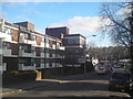
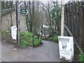
Living in CR8 3AA means residing within a specific residential cluster that forms part of the Purley and Woodcote Ward in the London Borough of Croydon. This postcode covers an area of 3232 square metres and is home to approximately 1719 people. The location sits roughly 11.7 miles south of Charing Cross, nestled near the border of Purley Oaks, Riddlesdown, Kenley, and Coulsdon. Historically, the surrounding locality derives its name from an Anglo-Saxon estate meaning a clearing where pear trees grow, known as Pirlea since around 1200. The ward was created in 2018, merging parts of the former Purley and Coulsdon West wards to encompass the Purley postal district and Woodcote to the west. Daily life here is shaped by its proximity to the historic Surrey Iron Railway, which once operated as one of the world's first horse-drawn toll railways between 1802 and 1803. Residents live close to Rotary Field, where an art installation called the Iron Horse celebrates this local heritage. The area features a suburban character, mixing early 20th-century developments with modern residential zones. You benefit from living in an estate that includes landmarks such as the Woodcote Model Village and the Bourne river, although the latter is culverted. The geometric precision of the postcode boundary contrasts with the organic history of the land, offering a defined yet historically rich environment for homeowners and settlers alike.
- Area Type
- Postcode
- Area Size
- 3232 m²
- Population
- Not available
- Population Density
- Not available
The property market in CR8 3AA is defined by a strong tradition of owner occupation, where 67% of residents own their homes. This high ownership percentage indicates that the area is not a transient rental market but rather a place where people settle permanently. The primary accommodation type comprises houses, which aligns with the suburban character of the Purley and Woodcote Ward. When you look at homes in CR8 3AA, you are likely viewing residential clusters that include both standard family properties and the distinct Edwardian homes found in the nearby Webb Estate. Living in this specific postcode means joining a community where investment in property has historically been significant. The Webb Estate, a gated community containing around 220 Edwardian homes, sits near Woodcote Village Green and offers a distinct "garden village" feel. This mix of standard suburban housing and the exclusive nature of the Webb Estate creates a varied yet consistent market. Buyers looking at this small area will find homes that reflect the early 20th-century development patterns mixed with later expansions. The high rate of home ownership suggests that residents value the stability of owning over renting, making the local market less volatile than areas with high rental turnover. Properties here tend to be substantial houses rather than flats or terracedbuildings found in denser urban cores.
House Prices in CR8 3AA
Showing 17 properties
| Address | Type | Beds | Baths | Last Sale Price | Last Sale Date | |
|---|---|---|---|---|---|---|
| 10B Brighton Road, Purley, CR8 3AA | Flat | 2 | 2 | £200,000 | Feb 2009 | |
| 12A Brighton Road, Purley, CR8 3AA | undefined | - | - | £300,000 | Jun 2001 | |
| Flat 5, 14 Brighton Road, Purley, CR8 3AA | Flat | 2 | 2 | - | - | |
| 10A Brighton Road, Purley, CR8 3AA | undefined | - | - | - | - | |
| Flat 11, 14 Brighton Road, Purley, CR8 3AA | Flat | - | - | - | - | |
| Flat 1, 14 Brighton Road, Purley, CR8 3AA | Flat | - | - | - | - | |
| Flat 14, 14 Brighton Road, Purley, CR8 3AA | Flat | - | - | - | - | |
| Flat 10, 14 Brighton Road, Purley, CR8 3AA | Flat | - | - | - | - | |
| Flat 4, 14 Brighton Road, Purley, CR8 3AA | Flat | - | - | - | - | |
| Flat 12, 14 Brighton Road, Purley, CR8 3AA | Flat | - | - | - | - |
Energy Efficiency in CR8 3AA
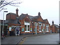
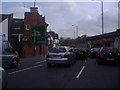
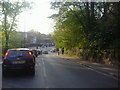
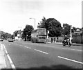
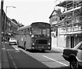
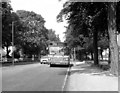
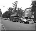
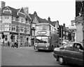
Your daily life in CR8 3AA benefits from a concentrated range of amenities located within a short walking or driving distance. For retail needs, you have access to five key shops, prominently including Tesco Purley, Sainsburys Purley, and the Co-op Kenley. These supermarkets ensure that all your grocery and household shopping requirements can be met locally without lengthy travels. Transportation infrastructure is equally accessible, with five rail stations and five metro tram stops nearby, including significant hubs like Purley Station and Lloyd Park Tram Stop. The neighbourhood offers a blend of suburban convenience and access to wider leisure facilities. Living in CR8 3AA puts you close to Woodcote Village Green and the Woodcote Model Village, spaces often used for local recreation and community events. The area borders Purley Oaks, Riddlesdown, and Kenley, providing easy access to larger parks and natural spaces. While the immediate postcode is small, the nearby amenities create a comprehensive lifestyle network. You can shop at Sainsburys or walk to the flagship railway station on Purley Way for broader options. The presence of local landmarks like the Surrey Iron Railway remnants in Rotary Field adds a historical element to your routine, offering moments of quiet reflection amidst the convenience of modern retail and transit options.
Amenities
Schools
Families living in CR8 3AA have access to specific educational institutions within their immediate vicinity. The most notable option listed for this postcode is St David's School, which operates as an independent institution. This single named school represents the primary non-state education choice for residents who prefer the independent sector. The presence of an independent school like St David's suggests that there is a demand for alternative education options beyond the comprehensive school model. St David's School offers a selective curriculum and typically caters to students adhering to a specific ethos, though specific Ofsted ratings are not provided in the available data for this cluster. For those relying on state-funded education, the ward's proximity to Purley high street and Woodcote Village Green places you in an educational corridor that serves the broader Croydon population. When considering schools near CR8 3AA, you must factor in travel time to the nearest large comprehensive institutions located in the wider Purley and Coulsdon wards. The mix of an independent school indicates that the area attracts families with the means or preference for private education, alongside those attending state schools in the surrounding estates. The quality of education in the immediate neighbourhood is anchored by the reputation and facilities of these named institutions.
| Rank | School | Type | Entry gender | Ages |
|---|
Explore more schools in this area
Go to Schools tabDemographics
The community in CR8 3AA reflects a settled population, where the most common age range consists of adults between 30 and 64 years. The median age for residents is 47, indicating a mature demographic that has likely put down roots in the neighbourhood for the long term. Home ownership stands at 67%, a figure that signals a high level of stability within this small cluster. This statistic suggests that the majority of households are occupied by people who own their homes rather than renting. The area contains an accommodation type dominated by houses, fitting the suburban description found in the wider Ward context. The predominant ethnic group is White, aligning with the demographic trends often seen in established Greater London suburbs. With a population density of 531894 people per square kilometre for this specific postcode, the neighbourhood feels intimate without being overpopulated. This age profile combined with high ownership rates creates an environment suitable for families raising children or retirees seeking a quiet setting. The high percentage of adults in their middle years implies that local services are oriented towards meeting the needs of working professionals and retired residents rather than young transient populations.
Household Size
Accommodation Type
Tenure
Ethnic Group
Religion
Household Composition
Age
Household Deprivation
NS-SEC
Explore more demographic insights in this area
Go to Demographics tabPlanning
Planning Constraints
- Flood RiskPremium
- Ramsar Wetland SitesPremium
- Area of Outstanding Natural BeautyPremium
- Protected Nature ReservePremium
- Protected WoodlandPremium