Area Overview for CR8 2HN
Photos of CR8 2HN
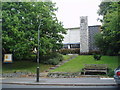

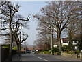
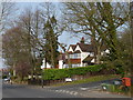
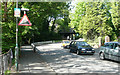
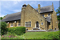
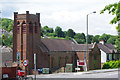
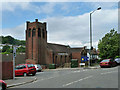
32 photos from this area
Area Information
Key information about the CR8 2HN including its size, population, and administrative classification.
- Area Type
- Postcode
- Area Size
- 2.2 hectares
- Population
- Not available
- Population Density
- Not available
House Prices in CR8 2HN
22
Properties
£570,300
Average Sold Price
£184,000
Lowest Price
£1,065,000
Highest Price
Showing 22 properties
| Address | Type | Beds | Baths | Last Sale Price | Last Sale Date | |
|---|---|---|---|---|---|---|
| 77 Higher Drive, Purley, CR8 2HN | Detached | 7 | 4 | £1,065,000 | Sep 2023 | |
| 79 Higher Drive, Purley, CR8 2HN | Detached | 4 | 2 | £900,000 | Jul 2023 | |
| 81A Higher Drive, Purley, CR8 2HN | Detached | 5 | 2 | £720,000 | Mar 2021 | |
| 89 Higher Drive, Purley, CR8 2HN | Detached | 5 | 3 | £650,000 | Jun 2014 | |
| 85 Higher Drive, Purley, CR8 2HN | Retail | 2 | 1 | £593,000 | Jul 2013 | |
| 87 Higher Drive, Purley, CR8 2HN | house | 5 | - | £500,000 | Jul 2012 | |
| 83 Higher Drive, Purley, CR8 2HN | Detached | - | - | £525,000 | Dec 2001 | |
| 77A Higher Drive, Purley, CR8 2HN | Detached | - | - | £330,000 | May 1999 | |
| 75 Higher Drive, Purley, CR8 2HN | Detached | - | - | £236,000 | Aug 1998 | |
| 73A Higher Drive, Purley, CR8 2HN | Detached | - | - | £184,000 | Apr 1995 |
Page 1 of 3
Energy Efficiency in CR8 2HN
Amenities
Schools
| Rank | School | Type | Entry gender | Ages |
|---|
Explore more schools in this area
Go to Schools tabDemographics
Household Size
Family (3-5 people)
most common
Accommodation Type
Houses
most common
Tenure
94
majority
Ethnic Group
White
most common
Religion
N/A
most common
Household Composition
N/A
most common
Age
47
median
Adults (30-64 years)
most common
Household Deprivation
N/A
with no deprivation
NS-SEC
52
in Lower managerial occupations
Explore more demographic insights in this area
Go to Demographics tabPlanning
Planning Constraints
- Flood RiskPremium
- Ramsar Wetland SitesPremium
- Area of Outstanding Natural BeautyPremium
- Protected Nature ReservePremium
- Protected WoodlandPremium