Area Overview for CR7 8YY
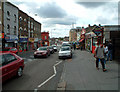
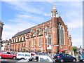
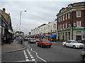
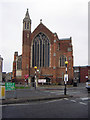
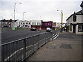
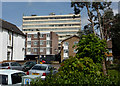
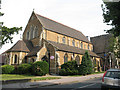
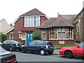
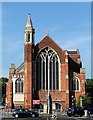
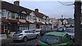
Photos of CR7 8YY


Area Information
Living in CR7 8YY means inhabiting a densely populated, small residential cluster in the London Borough of Croydon. With a population of 1,961 spread across 1,098 m², the area has a population density of 1,785,891 people per square kilometre, reflecting its compact nature. Historically rooted as a rural settlement around Thornton Heath Pond, the area evolved into a suburban hub after the 1862 railway station opened, linking it to London and Croydon. Today, CR7 8YY is characterised by Victorian terraced houses and a community shaped by its proximity to major transport routes like the A23 and multiple rail lines. The area’s identity is intertwined with its past as a site of Roman roads, 19th-century market gardening, and the development of Mayday University Hospital. Residents benefit from proximity to retail, transport, and healthcare, though the area’s growth has been overshadowed by nearby Norbury. For those seeking a mix of historical charm and modern connectivity, CR7 8YY offers a unique slice of South London’s suburban landscape.
- Area Type
- Postcode
- Area Size
- 1098 m²
- Population
- 1961
- Population Density
- 11129 people/km²
The property market in CR7 8YY is dominated by houses, with 47% of residents owning their homes. This suggests a mix of owner-occupied and rental properties, though the relatively low home ownership rate indicates a significant portion of the housing stock is available for rent. The area’s small size and historical development as a Victorian suburb mean properties are likely to be terraced or semi-detached, reflecting the era’s architectural style. For buyers, this presents a niche market with limited availability, as the area is compact and surrounded by denser urban zones. The presence of nearby amenities like schools and transport hubs may attract families or commuters, but the small size of CR7 8YY means competition for properties could be fierce. Prospective buyers should consider the area’s proximity to Croydon and London’s transport networks as key advantages.
House Prices in CR7 8YY
Showing 1 properties
| Address | Type | Beds | Baths | Last Sale Price | Last Sale Date | |
|---|---|---|---|---|---|---|
| Crown Building, 72 High Street, Thornton Heath, CR7 8YY | office_workshop | - | - | - | - |
Energy Efficiency in CR7 8YY
Living in CR7 8YY grants access to a range of amenities within practical reach. Retail options include Tesco Thornton, Iceland Thornton, and Sainsburys Crystal, offering everyday shopping convenience. Transport links are robust, with rail stations like Thornton Heath Station and tram stops such as Woodside Tram Stop providing easy access to London and Croydon. The area’s historical character is complemented by nearby landmarks like Thornton Heath Pond, which has been a focal point since the settlement’s origins. Victorian-era schools and the presence of Mayday University Hospital add to the area’s appeal. While the compact size means limited green spaces, the proximity to the A23 and transport hubs ensures residents can quickly reach parks, leisure facilities, and cultural attractions in surrounding areas. The blend of historical heritage and modern connectivity creates a dynamic lifestyle for residents.
Amenities
Schools
| Rank | School | Type | Entry gender | Ages |
|---|
Explore more schools in this area
Go to Schools tabDemographics
CR7 8YY has a median age of 47, with the majority of residents aged 30–64. Home ownership stands at 47%, indicating a significant proportion of the population rents. The accommodation type is predominantly houses, reflecting a mix of owner-occupied and rental properties. The predominant ethnic group is Black_total, though specific data on diversity beyond this category is not provided. The area’s demographic profile suggests a mature, settled community with a focus on family-oriented living. The high population density, combined with the age distribution, implies a balance between long-term residents and those seeking proximity to transport and amenities. While no explicit data on deprivation is given, the moderate home ownership rate may suggest varying economic conditions, with some residents relying on rental income or public services.
Household Size
Accommodation Type
Tenure
Ethnic Group
Religion
Household Composition
Age
Household Deprivation
NS-SEC
Explore more demographic insights in this area
Go to Demographics tabPlanning
Planning Constraints
- Flood RiskPremium
- Ramsar Wetland SitesPremium
- Area of Outstanding Natural BeautyPremium
- Protected Nature ReservePremium
- Protected WoodlandPremium