Area Overview for CR7 8QJ
Photos of CR7 8QJ
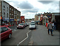

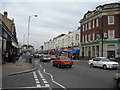
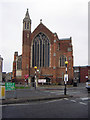
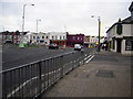
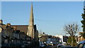
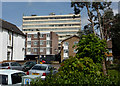
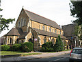
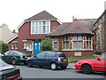


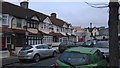
100 photos from this area
Area Information
Key information about the CR7 8QJ including its size, population, and administrative classification.
- Area Type
- Postcode
- Area Size
- 7012 m²
- Population
- 1632
- Population Density
- 11666 people/km²
House Prices in CR7 8QJ
38
Properties
£253,258
Average Sold Price
£54,500
Lowest Price
£530,000
Highest Price
Showing 38 properties
| Address | Type | Beds | Baths | Last Sale Price | Last Sale Date | |
|---|---|---|---|---|---|---|
| 11 Hunter Road, Thornton Heath, CR7 8QJ | house | - | - | £345,000 | Oct 2025 | |
| 49 Hunter Road, Thornton Heath, CR7 8QJ | house | - | - | £430,000 | Mar 2025 | |
| 45 Hunter Road, Thornton Heath, CR7 8QJ | Terraced | 3 | 1 | £516,700 | Mar 2024 | |
| 1 Hunter Road, Thornton Heath, CR7 8QJ | house | - | - | £477,000 | Dec 2021 | |
| 17 Hunter Road, Thornton Heath, CR7 8QJ | Terraced | 3 | 1 | £383,000 | Apr 2019 | |
| 29 Hunter Road, Thornton Heath, CR7 8QJ | Terraced | 3 | 1 | £390,000 | Apr 2019 | |
| 25 Hunter Road, Thornton Heath, CR7 8QJ | Terraced | 4 | - | £530,000 | Jan 2018 | |
| 21 Hunter Road, Thornton Heath, CR7 8QJ | Terraced | 3 | 1 | £350,000 | Feb 2016 | |
| 31 Hunter Road, Thornton Heath, CR7 8QJ | house | - | - | £235,000 | Apr 2007 | |
| 51 Hunter Road, Thornton Heath, CR7 8QJ | Maisonette | - | - | £145,000 | Jul 2006 |
Page 1 of 4
Energy Efficiency in CR7 8QJ
Amenities
Schools
| Rank | School | Type | Entry gender | Ages |
|---|
Explore more schools in this area
Go to Schools tabDemographics
Household Size
Family (3-5 people)
most common
Accommodation Type
Houses
most common
Tenure
64
majority
Ethnic Group
black_total
most common
Religion
N/A
most common
Household Composition
N/A
most common
Age
47
median
Adults (30-64 years)
most common
Household Deprivation
N/A
with no deprivation
NS-SEC
32
in Lower managerial occupations
Explore more demographic insights in this area
Go to Demographics tabPlanning
Planning Constraints
- Flood RiskPremium
- Ramsar Wetland SitesPremium
- Area of Outstanding Natural BeautyPremium
- Protected Nature ReservePremium
- Protected WoodlandPremium