Area Overview for CR4 8UU
Photos of CR4 8UU


Area Information
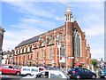
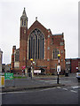
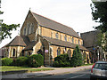
CR4 8UU is a small residential postcode area in England, encompassing a compact cluster of homes within the London Borough of Croydon. With a population of 1,632, it reflects a tight-knit community shaped by its historical roots as a rural settlement. Originally centred around Thornton Heath Pond, the area evolved rapidly after the arrival of a railway station in 1862, transforming into a suburban hub. Today, it retains echoes of its Victorian past, with terraced houses forming the backbone of its housing stock. The median age of 47 suggests a mature demographic, with adults aged 30–64 comprising the largest group. Living here means navigating a balance between suburban tranquillity and proximity to London’s infrastructure. The A23 road runs through the western edge, linking to Croydon and beyond, while rail and tram networks offer swift access to central London. Despite its modest size, CR4 8UU offers a mix of local amenities, from retail outlets to healthcare facilities, though its identity remains intertwined with the broader Croydon landscape.
- Area Type
- Postcode
- Area Size
- Not available
- Population
- 1632
- Population Density
- 11666 people/km²
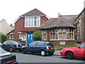
CR4 8UU is a predominantly owner-occupied area, with 64% of homes owned by residents rather than rented. The housing stock is largely composed of houses, reflecting a suburban layout typical of areas that developed as residential suburbs in the 19th century. This contrasts with newer developments that often feature flats or apartments, indicating that CR4 8UU retains a traditional character. The focus on houses may appeal to buyers seeking family homes or larger properties, though the area’s small size means the housing market is limited to a specific cluster of properties. Proximity to transport links, including rail and tram networks, enhances its appeal for commuters. However, buyers should consider the area’s integration with Croydon, as its identity as a distinct suburb is less pronounced than nearby Norbury. The predominance of owner-occupied homes suggests a community prioritising stability, though the lack of newer developments may limit property diversity.
House Prices in CR4 8UU
No properties found in this postcode.
Energy Efficiency in CR4 8UU
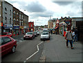
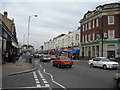
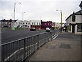
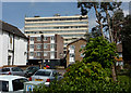
CR4 8UU offers a range of amenities within practical reach. Retail options include major chains such as Tesco Thornton, Iceland Thornton, and Sainsburys Crystal, providing everyday shopping convenience. The area’s transport links extend to multiple rail, metro, and ferry services, enabling swift access to London’s cultural and commercial hubs. While specific parks or leisure facilities are not detailed in the data, the historical presence of public baths and parks suggests some green spaces may exist. The nearby Mayday University Hospital and Thornton Heath Pond add to the area’s practicality, offering healthcare and recreational opportunities. The mix of retail and transport infrastructure supports a lifestyle that balances suburban comfort with urban accessibility, though residents may need to venture further for more specialised amenities.
Amenities
Schools
The only school explicitly listed near CR4 8UU is Arvon House, a special school. No other schools are referenced in the data, which means families seeking primary or secondary education may need to look beyond the immediate area. The absence of mainstream schools suggests that parents should investigate nearby districts for broader educational options. Arvon House’s presence indicates a focus on specialist provision, which may cater to specific needs within the community. However, the lack of data on other schools or their Ofsted ratings means prospective residents should conduct further research to assess the full range of educational facilities available. For families prioritising a comprehensive school network, CR4 8UU may require additional planning to ensure access to a variety of school types.
| Rank | School | Type | Entry gender | Ages |
|---|
Explore more schools in this area
Go to Schools tabDemographics
CR4 8UU’s population of 1,632 is predominantly composed of adults aged 30–64, reflecting a mature, established community. The median age of 47 indicates a demographic skewed towards middle-aged residents, which may influence local services and social dynamics. Home ownership stands at 64%, suggesting a stable housing market with a significant proportion of residents living in their own homes. The area is characterised by houses rather than flats, aligning with its suburban identity. The predominant ethnic group is Black residents, highlighting the area’s cultural diversity. While specific deprivation data is not provided, the presence of a large cemetery (opened 1861) and historical healthcare infrastructure, such as Mayday University Hospital, suggests a community with long-standing ties to public services. The age profile and ownership rates imply a focus on long-term residency, though the absence of younger families may affect local school populations and amenities.
Household Size
Accommodation Type
Tenure
Ethnic Group
Religion
Household Composition
Age
Household Deprivation
NS-SEC
Explore more demographic insights in this area
Go to Demographics tabPlanning
Planning Constraints
- Flood RiskPremium
- Ramsar Wetland SitesPremium
- Area of Outstanding Natural BeautyPremium
- Protected Nature ReservePremium
- Protected WoodlandPremium