Area Overview for CR7 8HU
Photos of CR7 8HU

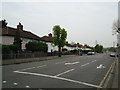
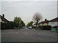
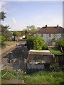
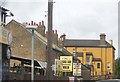
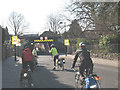
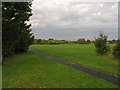
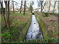

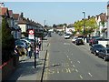
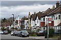
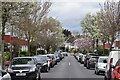
57 photos from this area
Area Information
Key information about the CR7 8HU including its size, population, and administrative classification.
- Area Type
- Postcode
- Area Size
- 9729 m²
- Population
- 1852
- Population Density
- 5577 people/km²
House Prices in CR7 8HU
58
Properties
£174,458
Average Sold Price
£32,000
Lowest Price
£476,000
Highest Price
Showing 58 properties
| Address | Type | Beds | Baths | Last Sale Price | Last Sale Date | |
|---|---|---|---|---|---|---|
| 63 Northwood Road, Thornton Heath, CR7 8HU | Terraced | - | - | £382,500 | Jul 2025 | |
| 9 Northwood Road, Thornton Heath, CR7 8HU | Flat | 1 | 1 | £257,000 | Feb 2025 | |
| 71 Northwood Road, Thornton Heath, CR7 8HU | Retail | 1 | 1 | £237,000 | Oct 2023 | |
| 15 Northwood Road, Thornton Heath, CR7 8HU | Flat | - | - | £225,000 | Nov 2022 | |
| 53 Northwood Road, Thornton Heath, CR7 8HU | house | 3 | 1 | £476,000 | Oct 2022 | |
| 19 Northwood Road, Thornton Heath, CR7 8HU | Flat | - | - | £150,000 | Apr 2022 | |
| 27A Northwood Road, Thornton Heath, CR7 8HU | Flat | - | - | £160,000 | Mar 2021 | |
| 79A Northwood Road, Thornton Heath, CR7 8HU | Maisonette | - | - | £205,000 | Mar 2020 | |
| 5 Northwood Road, Thornton Heath, CR7 8HU | Flat | 1 | 1 | £215,000 | Mar 2019 | |
| 75 Northwood Road, Thornton Heath, CR7 8HU | Flat | - | - | £252,500 | Aug 2016 |
Page 1 of 6
Energy Efficiency in CR7 8HU
Amenities
Schools
| Rank | School | Type | Entry gender | Ages |
|---|
Explore more schools in this area
Go to Schools tabDemographics
Household Size
Family (3-5 people)
most common
Accommodation Type
Houses
most common
Tenure
68
majority
Ethnic Group
White
most common
Religion
N/A
most common
Household Composition
N/A
most common
Age
47
median
Adults (30-64 years)
most common
Household Deprivation
N/A
with no deprivation
NS-SEC
33
in Lower managerial occupations
Explore more demographic insights in this area
Go to Demographics tabPlanning
Planning Constraints
- Flood RiskPremium
- Ramsar Wetland SitesPremium
- Area of Outstanding Natural BeautyPremium
- Protected Nature ReservePremium
- Protected WoodlandPremium