Area Overview for CR7 8HP
Photos of CR7 8HP
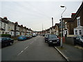
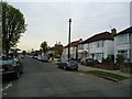
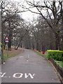
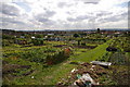
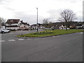
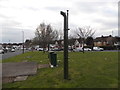
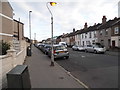
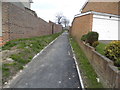
93 photos from this area
Area Information
Key information about the CR7 8HP including its size, population, and administrative classification.
- Area Type
- Postcode
- Area Size
- 6317 m²
- Population
- 1947
- Population Density
- 6065 people/km²
House Prices in CR7 8HP
19
Properties
£297,579
Average Sold Price
£86,000
Lowest Price
£445,000
Highest Price
Showing 19 properties
| Address | Type | Beds | Baths | Last Sale Price | Last Sale Date | |
|---|---|---|---|---|---|---|
| 4 Green Lane Gardens, Thornton Heath, CR7 8HP | house | - | - | £410,000 | Jun 2024 | |
| 9 Green Lane Gardens, Thornton Heath, CR7 8HP | Terraced | 3 | 1 | £445,000 | Dec 2020 | |
| 11 Green Lane Gardens, Thornton Heath, CR7 8HP | Terraced | 3 | 1 | £365,000 | Nov 2019 | |
| 5 Green Lane Gardens, Thornton Heath, CR7 8HP | Terraced | 3 | 1 | £300,000 | Feb 2014 | |
| 1 Green Lane Gardens, Thornton Heath, CR7 8HP | Semi-detached | 3 | 1 | £285,000 | Jul 2013 | |
| 14 Green Lane Gardens, Thornton Heath, CR7 8HP | house | - | - | £225,000 | Jan 2009 | |
| 3 Green Lane Gardens, Thornton Heath, CR7 8HP | house | - | - | £275,000 | Apr 2008 | |
| 13 Green Lane Gardens, Thornton Heath, CR7 8HP | Terraced | - | - | £335,000 | Mar 2007 | |
| 8 Green Lane Gardens, Thornton Heath, CR7 8HP | Terraced | - | - | £249,786 | Jul 2006 | |
| 10 Green Lane Gardens, Thornton Heath, CR7 8HP | Terraced | - | - | £86,000 | Oct 1998 |
Page 1 of 2
Energy Efficiency in CR7 8HP
Amenities
Schools
| Rank | School | Type | Entry gender | Ages |
|---|
Explore more schools in this area
Go to Schools tabDemographics
Household Size
Family (3-5 people)
most common
Accommodation Type
Houses
most common
Tenure
79
majority
Ethnic Group
asian_total
most common
Religion
N/A
most common
Household Composition
N/A
most common
Age
47
median
Adults (30-64 years)
most common
Household Deprivation
N/A
with no deprivation
NS-SEC
32
in Lower managerial occupations
Explore more demographic insights in this area
Go to Demographics tabPlanning
Planning Constraints
- Flood RiskPremium
- Ramsar Wetland SitesPremium
- Area of Outstanding Natural BeautyPremium
- Protected Nature ReservePremium
- Protected WoodlandPremium