Area Overview for CR4 2BJ
Photos of CR4 2BJ


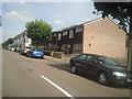


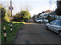
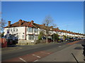

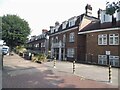
63 photos from this area
Area Information
Key information about the CR4 2BJ including its size, population, and administrative classification.
- Area Type
- Postcode
- Area Size
- 4594 m²
- Population
- 1620
- Population Density
- 21012 people/km²
House Prices in CR4 2BJ
46
Properties
£290,424
Average Sold Price
£48,950
Lowest Price
£550,000
Highest Price
Showing 46 properties
| Address | Type | Beds | Baths | Last Sale Price | Last Sale Date | |
|---|---|---|---|---|---|---|
| 21 Bruce Road, Mitcham, CR4 2BJ | Flat | 1 | 1 | £377,000 | Aug 2025 | |
| 1A Bruce Road, Mitcham, CR4 2BJ | Flat | 2 | 1 | £422,500 | Aug 2025 | |
| 33 Bruce Road, Mitcham, CR4 2BJ | Maisonette | 1 | 1 | £405,000 | Mar 2025 | |
| 43 Bruce Road, Mitcham, CR4 2BJ | Flat | 2 | 1 | £455,000 | Jul 2024 | |
| 37 Bruce Road, Mitcham, CR4 2BJ | Flat | - | - | £401,050 | Apr 2024 | |
| 9A Bruce Road, Mitcham, CR4 2BJ | Flat | - | - | £427,500 | Mar 2024 | |
| 21A Bruce Road, Mitcham, CR4 2BJ | Flat | 3 | 2 | £550,000 | Jan 2024 | |
| 35 Bruce Road, Mitcham, CR4 2BJ | Maisonette | 2 | 1 | £505,000 | Aug 2022 | |
| 11 Bruce Road, Mitcham, CR4 2BJ | Flat | 2 | - | £420,000 | Feb 2022 | |
| 39 Bruce Road, Mitcham, CR4 2BJ | Flat | - | - | £425,000 | Feb 2022 |
Page 1 of 5
Energy Efficiency in CR4 2BJ
Amenities
Schools
| Rank | School | Type | Entry gender | Ages |
|---|
Explore more schools in this area
Go to Schools tabDemographics
Household Size
Family (3-5 people)
most common
Accommodation Type
Flats
most common
Tenure
38
majority
Ethnic Group
White
most common
Religion
N/A
most common
Household Composition
N/A
most common
Age
47
median
Adults (30-64 years)
most common
Household Deprivation
N/A
with no deprivation
NS-SEC
38
in Lower managerial occupations
Explore more demographic insights in this area
Go to Demographics tabPlanning
Planning Constraints
- Flood RiskPremium
- Ramsar Wetland SitesPremium
- Area of Outstanding Natural BeautyPremium
- Protected Nature ReservePremium
- Protected WoodlandPremium