Area Overview for CR4 1JT
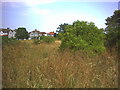
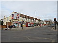
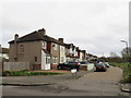
Photos of CR4 1JT


Area Information
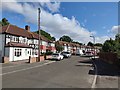
Living in CR4 1JT offers a distinct experience within the London Borough of Merton. This specific postcode covers only 6,199 square metres, forming a small, tightly knit residential cluster. You are part of the Longthornton ward, an established part of the Mitcham area that has evolved from its roots as a late 1920s estate built under the Small Dwellings Acquisitions Acts. The land once consisted of country lanes and market gardens before houses were constructed between 1926 and 1927 on sites belonging to the Marchant and Mizen families. Residents have historically advocated for better infrastructure, resulting in upgraded roads and local schools opening by 1930. Today, daily life here is characterised by a mature, stable environment where you interact with a community that has lived in the same geography for generations. The area blends the convenience of modern Manchester-style tram stops and railway lines with the quiet atmosphere of a late interwar development. You do not need to travel far to reach major transport hubs, yet you remain rooted in a neighbourhood with original character. This mix of historical depth and modern connectivity defines the identity of CR4 1JT.
- Area Type
- Postcode
- Area Size
- 6199 m²
- Population
- 1586
- Population Density
- 4936 people/km²
The property market in CR4 1JT is defined by stability and self-occupation. You will find that 75% of the homes in this postcode are owner-occupied, creating a market driven by long-term residents rather than high turnover or investment speculation. The predominant accommodation type comprises houses, meaning you are looking for traditional family dwellings rather than urban apartment blocks. This high rate of ownership typically signals a well-maintained housing stock where caretakers have a vested interest in preserving property values. Those buying homes in this cluster are joining a group where nearly three-quarters of neighbours have purchased their properties outright or via mortgage. The architecture reflects the late 1920s construction dates, offering period properties that have stood the test of time since the Longthornton Park Estate was developed on former market gardens. Because the area covers such a small 6,199 square metre footprint, the variation in housing stock is limited, and the demand is consistently focused on these specific house types. You are entering a market where certainty and consistency outweigh the rapid changes found in other parts of south London.
House Prices in CR4 1JT
Showing 27 properties
| Address | Type | Beds | Baths | Last Sale Price | Last Sale Date | |
|---|---|---|---|---|---|---|
| 165 Manor Road, Mitcham, CR4 1JT | Terraced | 3 | 1 | £460,000 | Mar 2025 | |
| 143 Manor Road, Mitcham, CR4 1JT | Terraced | 3 | 1 | £425,000 | Feb 2025 | |
| 155 Manor Road, Mitcham, CR4 1JT | Terraced | 3 | 1 | £450,000 | Sep 2024 | |
| 147 Manor Road, Mitcham, CR4 1JT | Semi-detached | 3 | 1 | £400,000 | May 2019 | |
| 137 Manor Road, Mitcham, CR4 1JT | Terraced | 3 | 1 | £401,000 | Mar 2019 | |
| 139 Manor Road, Mitcham, CR4 1JT | Terraced | 3 | 1 | £386,000 | Dec 2018 | |
| 129 Manor Road, Mitcham, CR4 1JT | Terraced | 2 | 1 | £287,500 | Nov 2018 | |
| 127 Manor Road, Mitcham, CR4 1JT | Terraced | 4 | 2 | £350,000 | Nov 2018 | |
| 125 Manor Road, Mitcham, CR4 1JT | Terraced | 3 | 2 | £389,950 | Oct 2015 | |
| 151 Manor Road, Mitcham, CR4 1JT | house | - | - | £235,000 | Jan 2014 |
Energy Efficiency in CR4 1JT
Your daily life in CR4 1JT revolves around a range of practical amenities within easy reach. For retail needs, you have five key options including Co-op South, Lidl Rowan, and Morrisons Daily, ensuring that all shopping requirements are met without the need for a long car journey. Transport convenience is equally significant, with five rail stations and five tram stops located nearby to facilitate quick trips to central London. The wider area offers five ferry terminals, providing river views and leisure potential alongside practical travel options. While specific park names are not listed in the immediate amenity breakdown, the historical record notes that the estate was developed on land previously comprising country lanes and market gardens belonging to the Marchant and Mizen families. Residents were actively involved in forming the Long Thornton and District Improvement Association to secure better local facilities, including improved roads and schools opened by 1930. This legacy of community engagement continues today through the ward's representation within the London Borough of Merton. You live in a zone where essential services are consolidated, allowing you to manage your weekly routine efficiently.
Amenities
Schools
| Rank | School | Type | Entry gender | Ages |
|---|
Explore more schools in this area
Go to Schools tabDemographics
The community within CR4 1JT reflects the broader demographic profile of Longthornton. You are joining a neighbourhood where the median age is 47 years, meaning the most common age range among residents comprises adults aged 30 to 64. This indicates a settled population rather than a transient student or young professional group. Home ownership stands at an impressive 75%, suggesting that the majority of households define themselves as owners rather than tenants. The predominant accommodation type consists of houses, distinguishing this postcode from areas dominated by flats or studio apartments. The most common ethnic group in the area is White. With a total population of 1,586 people confined to this small footprint, you live in a compact community where local businesses and services are dedicated to serving a specific, finite group of neighbours. The high density of 255,853 people per square kilometre results from the very small total area size, creating an environment where public spaces and local networks are instantly recognisable to long-term residents.
Household Size
Accommodation Type
Tenure
Ethnic Group
Religion
Household Composition
Age
Household Deprivation
NS-SEC
Explore more demographic insights in this area
Go to Demographics tabPlanning
Planning Constraints
- Flood RiskPremium
- Ramsar Wetland SitesPremium
- Area of Outstanding Natural BeautyPremium
- Protected Nature ReservePremium
- Protected WoodlandPremium