Area Overview for CR2 9BU
Photos of CR2 9BU
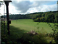
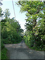
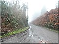
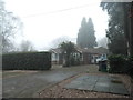
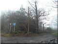
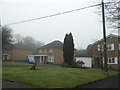
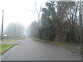
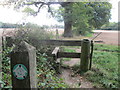
27 photos from this area
Area Information
Key information about the CR2 9BU including its size, population, and administrative classification.
- Area Type
- Postcode
- Area Size
- 6.6 hectares
- Population
- Not available
- Population Density
- Not available
House Prices in CR2 9BU
45
Properties
£327,257
Average Sold Price
£67,750
Lowest Price
£565,000
Highest Price
Showing 45 properties
| Address | Type | Beds | Baths | Last Sale Price | Last Sale Date | |
|---|---|---|---|---|---|---|
| 63 Harewood Gardens, South Croydon, CR2 9BU | Terraced | 4 | 2 | £550,000 | Sep 2025 | |
| 49 Harewood Gardens, South Croydon, CR2 9BU | Terraced | 3 | 1 | £435,000 | Jul 2024 | |
| 3E Harewood Gardens, South Croydon, CR2 9BU | house | - | - | £550,000 | Feb 2023 | |
| 67 Harewood Gardens, South Croydon, CR2 9BU | house | - | - | £475,000 | Jan 2023 | |
| 3D Harewood Gardens, South Croydon, CR2 9BU | house | - | - | £565,000 | Jan 2023 | |
| 3A Harewood Gardens, South Croydon, CR2 9BU | house | - | - | £550,000 | Jan 2023 | |
| 53 Harewood Gardens, South Croydon, CR2 9BU | Semi-detached | 5 | 3 | £500,000 | Feb 2022 | |
| 31 Harewood Gardens, South Croydon, CR2 9BU | house | - | - | £530,000 | Feb 2022 | |
| 5 Harewood Gardens, South Croydon, CR2 9BU | Detached | - | - | £502,000 | Jul 2021 | |
| 59 Harewood Gardens, South Croydon, CR2 9BU | Semi-detached | 3 | 1 | £370,000 | Nov 2015 |
Page 1 of 5
Energy Efficiency in CR2 9BU
Amenities
Schools
| Rank | School | Type | Entry gender | Ages |
|---|
Explore more schools in this area
Go to Schools tabDemographics
Household Size
Family (3-5 people)
most common
Accommodation Type
Houses
most common
Tenure
70
majority
Ethnic Group
White
most common
Religion
N/A
most common
Household Composition
N/A
most common
Age
47
median
Adults (30-64 years)
most common
Household Deprivation
N/A
with no deprivation
NS-SEC
34
in Lower managerial occupations
Explore more demographic insights in this area
Go to Demographics tabPlanning
Planning Constraints
- Flood RiskPremium
- Ramsar Wetland SitesPremium
- Area of Outstanding Natural BeautyPremium
- Protected Nature ReservePremium
- Protected WoodlandPremium