Area Overview for CR2 9BG
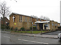
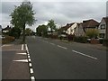
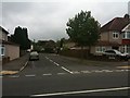
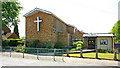
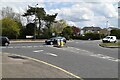
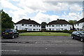
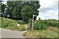
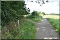
Photos of CR2 9BG
Area Information
Living in CR2 9BG offers a compact residential experience within a very defined boundary. This specific postcode covers an area of just 1.1 hectares and serves a population of 1,503 people. The density here reaches 133,211 people per square kilometre, creating a tightly knit cluster where neighbours are likely aware of one another. You will find yourself in a location that balances quiet residential streets with proximity to broader South London amenities. The area sits firmly within the London Borough of Croydon, connecting you to the history and development of Sanderstead, a ward that has undergone significant boundary changes in 2018. Daily life in this small postcode revolves around the practicalities of modern living without the sprawl of larger suburbs. You benefit from low flood risk and a clean slate regarding protected land designations like AONBs or Ramsar sites. This stability makes the environment suitable for those seeking a settled home base. The community reflects a mature demographic, with a median age of 47, suggesting a prevalence of families and established professionals rather than a transient young adult population. You are accessing a specific slice of Croydon where housing has historically consisted of houses, catering to families looking for space.
- Area Type
- Postcode
- Area Size
- 1.1 hectares
- Population
- 1503
- Population Density
- 3487 people/km²
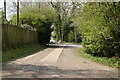
The property market in CR2 9BG is distinctly anchored by homeownership. With 81 percent of the population owning their homes, the area functions primarily as an owner-occupied zone rather than a rental hub. The predominant accommodation type is houses, meaning you will look primarily at detached, semi-detached, or detached family properties. This creates a specific market segment where buyers compete for established family homes in a small 1.1-hectare stretch containing 1,503 people. The high saturation of homeownership suggests that many properties are sold only when current owners downsize or move away, rather than due to temporary rent-to-buy arrangements. For those seeking homes in CR2 9BG, the inventory is limited by the small physical footprint of the postcode. You must act quickly as turnover is generally lower in areas where most residents own their properties long-term. The market reflects the stability of the wider Sanderstead ward, where boundaries were adjusted in 2018 to include territory from Croham. This historical context influences the style and layout of the available properties, which typically range from early twentieth-century developments to more recent builds. The absence of high-rise blocks or student accommodation means the property values are driven by family utility and local infrastructure. Buyers here are often purchasing for lifestyle stability rather than investment speculation. The consistency of the housing stock ensures that visual amenity remains uniform across the small area.
House Prices in CR2 9BG
Showing 26 properties
| Address | Type | Beds | Baths | Last Sale Price | Last Sale Date | |
|---|---|---|---|---|---|---|
| 30 Harewood Gardens, South Croydon, CR2 9BG | Detached | 3 | 1 | £530,000 | Nov 2025 | |
| 38 Harewood Gardens, South Croydon, CR2 9BG | house | - | - | £450,000 | Dec 2024 | |
| 14 Harewood Gardens, South Croydon, CR2 9BG | house | - | - | £445,000 | Nov 2024 | |
| 42 Harewood Gardens, South Croydon, CR2 9BG | house | 5 | 2 | £540,000 | Sep 2024 | |
| 22 Harewood Gardens, South Croydon, CR2 9BG | Semi-detached | 3 | 1 | £450,000 | Feb 2024 | |
| 48 Harewood Gardens, South Croydon, CR2 9BG | house | - | - | £540,000 | Feb 2023 | |
| 2 Harewood Gardens, South Croydon, CR2 9BG | house | - | - | £605,000 | May 2022 | |
| 34 Harewood Gardens, South Croydon, CR2 9BG | house | 3 | - | £520,000 | Jun 2021 | |
| 16 Harewood Gardens, South Croydon, CR2 9BG | house | 3 | - | £455,000 | Apr 2020 | |
| 4 Harewood Gardens, South Croydon, CR2 9BG | house | - | - | £478,000 | Jan 2018 |
Energy Efficiency in CR2 9BG
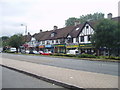
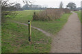
Your lifestyle in CR2 9BG is defined by convenience and accessible shops. Five retail locations are within practical reach, including Co-op Hamsey, Waitrose Sanderstead, and Cook Sanderstead. These venues provide essential goods, groceries, and daily necessities without requiring long travel times. Dining and shopping needs are met locally, supporting a walkable routine for residents who prefer not to drive. The presence of Waitrose suggests access to quality provisions, which appeals to the middle-aged demographic typical of the area. Transport facilities further enhance your daily routine. You can access five railway stations and five tram stops, making travel to work or leisure straightforward. Proximity to London Biggin Hill Airport adds versatility for business travellers or holidaymakers. While this postcode lacks extensive parks within its 1.1-hectare boundary, historical context reveals the area's connection to Sanderstead, a ward known for its churchyard listed as a Grade 1 historic building. All Saints Churchyard offers a green space with archaeological significance, reflecting the deep roots of the community dating back to the Domesday Book. The lifestyle here is practical, focusing on efficient access to retail and transport networks rather than waterfront or natural reserves, which are absent in the immediate vicinity.
Amenities
Schools
| Rank | School | Type | Entry gender | Ages |
|---|
Explore more schools in this area
Go to Schools tabDemographics
The community living in CR2 9BG is characterised by a mature population structure. Seventy-nine percent of residents fall into adult age ranges between 30 and 64 years old, with the median age standing at 47 years. This indicates an established community where the majority of households are formed by adults rather than students or young singles. You are entering an area where home ownership is the dominant arrangement, with 81 percent of residents owning their property outright. This high level of ownership suggests stability and a long-term commitment to the locality. The primary accommodation type found here is houses, which aligns with the ownership figures and the preference of the age demographic. While the data does not break down ethnicity in granular detail, the predominant ethnic group is White, reflecting the historical character of South London wards like Sanderstead. This demographic profile supports a neighbourhood where raises and children are common, given the family-oriented housing stock. The high ownership rate and medium-to-high age bracket often correlate with lower deprivation levels, contributing to a stable quality of life. You will find a resident base that has likely lived in their homes for many years, creating a sense of continuity. The housing stock is not mixed with high-rise flats or student lodgings, maintaining a consistent residential character.
Household Size
Accommodation Type
Tenure
Ethnic Group
Religion
Household Composition
Age
Household Deprivation
NS-SEC
Explore more demographic insights in this area
Go to Demographics tabPlanning
Planning Constraints
- Flood RiskPremium
- Ramsar Wetland SitesPremium
- Area of Outstanding Natural BeautyPremium
- Protected Nature ReservePremium
- Protected WoodlandPremium