Area Overview for CR2 7YN
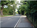
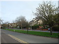
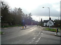
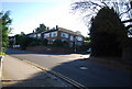
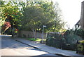
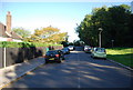
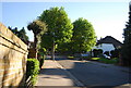
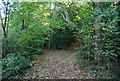
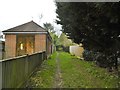
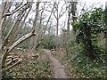
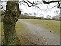
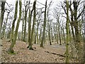
Photos of CR2 7YN
Area Information
Living in CR2 7YN offers a compact, residential experience within the London Borough of Croydon. This small postcode area, spanning 4,445 square metres, is home to 1,621 people, creating a densely populated yet focused community. The area’s history is rooted in 19th-century development on land from Croham and Haling manors, with landmarks like Croham Hurst, a 34-hectare woodland, and the Whitgift Foundation’s legacy shaping its character. Residents benefit from proximity to transport hubs, including five tram stops and five rail stations, such as South Croydon and Purley Oaks. The mix of independent and state schools, like Croham Hurst School and Coombe Wood Academy, caters to families. With a population skewed toward adults aged 30–64, CR2 7YN is a place of stability, where 75% of homes are owner-occupied, and daily life balances suburban tranquility with urban connectivity.
- Area Type
- Postcode
- Area Size
- 4445 m²
- Population
- 1621
- Population Density
- 1915 people/km²
CR2 7YN is primarily an owner-occupied area, with 75% of homes owned by their residents. The accommodation type is predominantly houses, which is typical for suburban settings. This suggests a market where property values are likely stable, with fewer rental properties available. The small size of the area means housing stock is limited, but proximity to nearby amenities and transport links may make it attractive for buyers seeking a balance between residential space and urban access. For those considering the area, the focus on houses rather than flats implies a preference for family-friendly, long-term living. Buyers should note that the limited size of CR2 7YN itself may mean opportunities are concentrated in immediate surrounding areas.
House Prices in CR2 7YN
Showing 2 properties
| Address | Type | Beds | Baths | Last Sale Price | Last Sale Date | |
|---|---|---|---|---|---|---|
| Residential Accommodation, The Limes, Melville Avenue, South Croydon, CR2 7YN | Unknown | - | - | - | - | |
| The Limes, Melville Avenue, South Croydon, CR2 7YN | commercial | - | - | - | - |
Energy Efficiency in CR2 7YN
Living in CR2 7YN offers a blend of convenience and accessibility. Residents can access five metro stops, five rail stations, and major retail outlets like Sainsburys and Tesco, making daily errands straightforward. The nearby Croham Hurst, a 34-hectare woodland, provides green space for leisure and outdoor activities. The area’s proximity to South Croydon bus garage and historic routes like Brighton Road adds to its transport versatility. While the small postcode area itself is compact, the surrounding region offers a broader range of amenities, from dining options to cultural sites. This combination of local convenience and regional connectivity ensures a lifestyle that balances suburban comfort with urban accessibility.
Amenities
Schools
Residents of CR2 7YN have access to a range of school options. Croham Hurst School is an independent institution, offering a private education pathway. Rutherford School, a special school with an Ofsted rating of ‘good’, supports students with specific needs, while Coombe Wood School, an academy with the same ‘good’ rating, provides state education. This mix of school types ensures families can choose between independent and state-funded options, depending on their priorities. The presence of two ‘good’-rated schools in the area suggests a strong educational infrastructure, which is a key consideration for families. The proximity of these schools to homes in CR2 7YN enhances the area’s appeal for those prioritising quality education.
| Rank | School | Type | Entry gender | Ages |
|---|
Explore more schools in this area
Go to Schools tabDemographics
CR2 7YN’s population of 1,621 is predominantly composed of adults aged 30–64, with a median age of 47. This suggests a mature, established community, likely with long-term residents. Home ownership is high, at 75%, indicating a stable housing market where most residents live in their own homes. The area is characterised by houses rather than flats, reflecting a suburban layout. The predominant ethnic group is White, though no specific diversity figures are provided. The population density of 364,658 people per square kilometre is exceptionally high, which may influence the area’s compact, closely knit feel. While no deprivation data is available, the high home ownership rate and presence of quality schools suggest a relatively affluent or stable demographic.
Household Size
Accommodation Type
Tenure
Ethnic Group
Religion
Household Composition
Age
Household Deprivation
NS-SEC
Explore more demographic insights in this area
Go to Demographics tabPlanning
Planning Constraints
- Flood RiskPremium
- Ramsar Wetland SitesPremium
- Area of Outstanding Natural BeautyPremium
- Protected Nature ReservePremium
- Protected WoodlandPremium