Area Overview for CR2 7HY
Photos of CR2 7HY
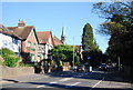
100 photos from this area
Area Information
Key information about the CR2 7HY including its size, population, and administrative classification.
- Area Type
- Postcode
- Area Size
- 7.4 hectares
- Population
- 1621
- Population Density
- 1915 people/km²
House Prices in CR2 7HY
16
Properties
£430,859
Average Sold Price
£59,995
Lowest Price
£1,035,000
Highest Price
Showing 16 properties
| Address | Type | Beds | Baths | Last Sale Price | Last Sale Date | |
|---|---|---|---|---|---|---|
| 14E Melville Avenue, South Croydon, CR2 7HY | Maisonette | 2 | - | £400,000 | Mar 2025 | |
| 14F Melville Avenue, South Croydon, CR2 7HY | Maisonette | 3 | 2 | £437,000 | May 2021 | |
| 14D Melville Avenue, South Croydon, CR2 7HY | Flat | - | - | £345,000 | Jun 2019 | |
| 24 Melville Avenue, South Croydon, CR2 7HY | Detached | 4 | - | £425,000 | Aug 2013 | |
| 18 Melville Avenue, South Croydon, CR2 7HY | Detached | 5 | - | £1,035,000 | Dec 2011 | |
| 26 Melville Avenue, South Croydon, CR2 7HY | house | - | - | £565,000 | Aug 2005 | |
| 22 Melville Avenue, South Croydon, CR2 7HY | Detached | - | - | £370,000 | Jul 2005 | |
| 16 Melville Avenue, South Croydon, CR2 7HY | Detached | - | - | £890,000 | Oct 2004 | |
| 14A Melville Avenue, South Croydon, CR2 7HY | Flat | - | - | £59,995 | Nov 1998 | |
| 14B Melville Avenue, South Croydon, CR2 7HY | Flat | - | - | £62,500 | Aug 1995 |
Page 1 of 2
Energy Efficiency in CR2 7HY
Amenities
Schools
| Rank | School | Type | Entry gender | Ages |
|---|
Explore more schools in this area
Go to Schools tabDemographics
Household Size
Two person
most common
Accommodation Type
Houses
most common
Tenure
75
majority
Ethnic Group
White
most common
Religion
N/A
most common
Household Composition
N/A
most common
Age
47
median
Adults (30-64 years)
most common
Household Deprivation
N/A
with no deprivation
NS-SEC
53
in Lower managerial occupations
Explore more demographic insights in this area
Go to Demographics tabPlanning
Planning Constraints
- Flood RiskPremium
- Ramsar Wetland SitesPremium
- Area of Outstanding Natural BeautyPremium
- Protected Nature ReservePremium
- Protected WoodlandPremium