Area Overview for CR2 6HP
Photos of CR2 6HP
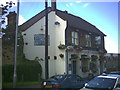
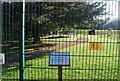
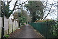
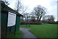
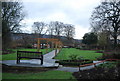
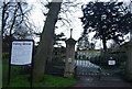
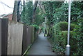
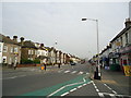
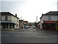
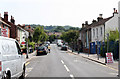
91 photos from this area
Area Information
Key information about the CR2 6HP including its size, population, and administrative classification.
- Area Type
- Postcode
- Area Size
- 6709 m²
- Population
- 1721
- Population Density
- 8857 people/km²
House Prices in CR2 6HP
32
Properties
£316,899
Average Sold Price
£55,000
Lowest Price
£475,000
Highest Price
Showing 32 properties
| Address | Type | Beds | Baths | Last Sale Price | Last Sale Date | |
|---|---|---|---|---|---|---|
| 3 Mansfield Road, South Croydon, CR2 6HP | Terraced | 3 | 1 | £408,000 | Sep 2025 | |
| 43 Mansfield Road, South Croydon, CR2 6HP | Terraced | 3 | 1 | £445,000 | Jul 2025 | |
| 19 Mansfield Road, South Croydon, CR2 6HP | Terraced | 2 | 1 | £412,000 | Oct 2024 | |
| 37 Mansfield Road, South Croydon, CR2 6HP | Terraced | 2 | 1 | £430,000 | Mar 2023 | |
| 57 Mansfield Road, South Croydon, CR2 6HP | Retail | 3 | 1 | £475,000 | Oct 2022 | |
| 25 Mansfield Road, South Croydon, CR2 6HP | Retail | 2 | 1 | £462,500 | Jul 2022 | |
| 13 Mansfield Road, South Croydon, CR2 6HP | Terraced | 2 | 1 | £376,719 | Dec 2021 | |
| 29 Mansfield Road, South Croydon, CR2 6HP | house | 2 | - | £472,000 | Sep 2021 | |
| 55 Mansfield Road, South Croydon, CR2 6HP | Terraced | 3 | 1 | £450,000 | Jun 2021 | |
| 33 Mansfield Road, South Croydon, CR2 6HP | Terraced | 2 | - | £397,500 | Mar 2021 |
Page 1 of 4
Energy Efficiency in CR2 6HP
Amenities
Schools
| Rank | School | Type | Entry gender | Ages |
|---|
Explore more schools in this area
Go to Schools tabDemographics
Household Size
Family (3-5 people)
most common
Accommodation Type
Houses
most common
Tenure
60
majority
Ethnic Group
White
most common
Religion
N/A
most common
Household Composition
N/A
most common
Age
47
median
Adults (30-64 years)
most common
Household Deprivation
N/A
with no deprivation
NS-SEC
42
in Lower managerial occupations
Explore more demographic insights in this area
Go to Demographics tabPlanning
Planning Constraints
- Flood RiskPremium
- Ramsar Wetland SitesPremium
- Area of Outstanding Natural BeautyPremium
- Protected Nature ReservePremium
- Protected WoodlandPremium